
The most misread number in Colorado
Colorado's fourteeners — by the standard finishers' count, 58 named summits above 14,000 ft (4,267 m), spread across 7 ranges and topped by Mount Elbert at 14,440 ft (4,401 m) — are each summed up in guidebooks and trip reports by a single small integer: Class 1 through Class 4 on the Yosemite Decimal System's class scale. (Global Summit Guide; The Next Summit)
It is the most load-bearing number in American peak-bagging, and the most misread. The class grades the hardest required move on the route — what your hands will do. It says nothing about exposure, rock quality, storm timing, descent complexity or how many people have died there. US hikers routinely translate "no rope needed" into "safe." The record says otherwise: "Class 3" Longs Peak has 19 deaths above the Keyhole, and "Class 4" Capitol Peak killed an unprecedented five people in a six-week span in 2017. (Rocky Mountain Hiking Trails; AAC Publications)
Here is the scale, read through five real mountains — one per rung, in the order a sane progression climbs them.
What the four numbers actually say
| Class | Terrain | The shorthand |
|---|---|---|
| 1 | Established trail all the way | Hands in pockets |
| 2 | Off-trail travel, occasional hand for balance | Hands out of pockets |
| 3 | Sustained scrambling with exposure | Hands on rock, frequently |
| 4 | Simple climbing where the line to Class 5 is hazy | An unroped fall is likely fatal |
| 5 | Technical climbing — ropes, protection | Off the hiking scale entirely |
Sources: The Next Summit — What are the classes of 14ers?; ZeroTo14k — Trail classifications.
Two structural facts: standard 14er routes run Class 1-4 only (the last rung below shows where the scale exits), and the steps are not evenly spaced — the jump from 2 to 3 changes what a slip means; 3 to 4, whether you survive one.
Continue reading Longs Peak is not a hike: the Keyhole Route, hour by hour →
The ladder: five peaks, five rungs
| Rung | Peak (standard route) | Summit | The day |
|---|---|---|---|
| Class 1 | Quandary Peak (East Ridge) | 14,265 ft (4,348 m) | 6.75 mi (10.9 km), 3,450 ft (1,052 m) gain |
| Class 2 | Mount Bierstadt (West Slopes) | 14,065 ft (4,287 m) | 7.0 mi (11.3 km), 2,850 ft (869 m) gain |
| Class 3 | Longs Peak (Keyhole Route) | 14,259 ft (4,346 m) | ~14.5-16 mi (23-26 km), ~4,875-5,100 ft (1,486-1,554 m) gain |
| Class 4 | Capitol Peak (via the Knife Edge) | 14,137 ft (4,309 m) | one of Colorado's most challenging 14ers |
| Class 5 | The Bells Traverse | 14,156 → 14,014 ft (4,315 → 4,271 m) | ~9.5 mi (15.3 km), ~4,850 ft (1,478 m) day |
Class 1 — Quandary Peak, East Ridge
Trail from parking lot to summit: 6.75 mi (10.9 km) round trip, 3,450 ft (1,052 m) of gain, about 6 hours for an average party, on one of Colorado's most popular fourteeners. (The Next Summit; GoBreck) What Class 1 buys you is terrain simplicity — not an easy day. The trailhead sits around 10,800 ft (~3,300 m), an elevation most mountain ranges reserve for high camps, and the modern catch is arrival, not rock: Summit County runs paid managed access June 13-September 13, 2026 — $30 weekday / $55 Friday-Sunday full-day parking, or a $7 round-trip shuttle from Breckenridge. (Summit County)
Class 2 — Mount Bierstadt, West Slopes
From the top of Guanella Pass — a paved, two-mile-high road pass — Bierstadt's standard line is 7.0 mi (11.3 km) and 2,850 ft (869 m) to a 14,065-ft (4,287 m) summit. Class 2 means the trail frays: sections of off-trail travel where a hand comes out for balance. The route guide's own caveat frames the whole bottom of the scale: it is "relatively easy compared to other peaks," but "still requires you to hike for 7 miles and gain nearly 3,000 feet of elevation in a low-oxygen environment." (The Next Summit; summit elevation — Global Summit Guide) Easiest 14er is a relative title. There are no easy ones.
Class 3 — Longs Peak, Keyhole Route
The National Park Service's own bulletin is the sharpest line in the American grading literature: "The Keyhole Route is not a hike. This is a climb" — across enormous sheer vertical rock faces, often with falling rocks, where an unroped fall would likely be fatal, and where winter-like conditions occur year-round. (NPS; Keyhole Route site bulletin)
That is what Class 3 means at full scale. The day: guide-operator specs run a 12:00-2:00 a.m. start, about 16 mi (26 km) round trip, 4,875 ft (1,486 m) of gain and a 10-18-hour outing (KMAC Guides, which guides it from $650 solo / $1,050 for two); an independent account logs 14.5 mi (23.3 km) and 5,100 ft (1,554 m) — "a beefy day hike, for sure" — through the named upper sections: the Ledges, the Trough, the Narrows, the Home Stretch. (Dismal Wilderness) The Next Summit pegs Longs as the canonical Colorado Class 3 (TNS) — and its fatality ledger, below, is the canonical argument that the number is not a safety rating.
Class 4 — Capitol Peak, the Knife Edge
Capitol, 14,137 ft (4,309 m) in the Elk Range, is what the American Alpine Club calls "one of Colorado's most challenging 14ers," and its crux — the Knife Edge — is the state's most famous stretch of 4th-class ridge. (AAC Publications) Class 4 is where the definitional hedge — "simple climbing where the line to Class 5 is hazy" — meets the Elks' geology: the range's red rock is mudstone, "loose, rotten, downsloping and unstable... every handhold and foothold must be tested." (Roaming Together) On solid granite, Class 4 moves are easy; on rock that comes off in your hand, the grade understates the game — as the summer of 2017 proved (below).
Class 5 — the Bells Traverse, where the scale exits
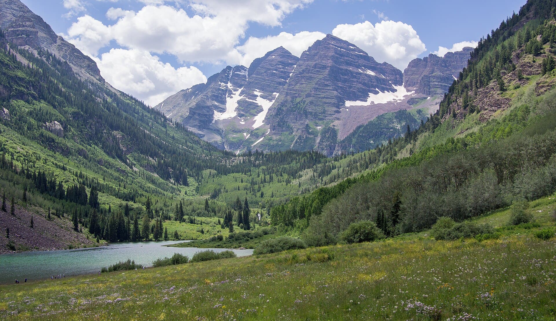
The Maroon Bells are the most photographed mountains in Colorado and among its most lethal — "known historically as the Deadly Bells due to the high number of deaths here," with the famous warning sign still standing on the approach. On their standard lines, South Maroon (14,156 ft / 4,315 m) is Class 3 and North Maroon (14,014 ft / 4,271 m) is Class 4. (Roaming Together; Dismal Wilderness) The 0.4-mi (0.6 km) ridge connecting them — the Bells Traverse — is low Class 5: real rock climbing, not scrambling, on a roughly 9.5-mi (15.3 km), 4,850-ft (1,478 m) day. (Turn The Payge) Aspen Expeditions guides it at $1,287.50 solo / $1,545 for two — their longest single-day outing. (Aspen Expeditions) The point of the top rung: the same massif carries three different class numbers depending on which line you are standing on.
58 or 53: why the count can't settle either
The class number is a judgment call; the peak count is a convention. The community's standard finishers' list counts 58 named summits above 14,000 ft. Apply the stricter 300-ft (91 m) prominence rule — a summit must rise at least 300 ft above the saddle connecting it to a higher peak — and the list trims to 53 ranked peaks. Neither number is wrong — they answer different questions — and the 58-peak convention dominates actual usage. (Global Summit Guide)
3.6 inches: the survey that may rewrite the ranked list
If that sounds settled, it isn't. On October 5, 2025, a GNSS survey team led by mountaineering scientist Eric Gilbertson measured East Crestone — long considered a subpeak — at 14,299.3 ft (4,358.4 m): about a third of a foot, a 3.6-inch (9 cm) discrepancy, taller than neighboring Crestone Peak. Under the 300-ft prominence rule, that would see East Crestone replace Crestone Peak on the ranked list. No official adoption yet. (Colorado Sun; KUNC) A list rewritable by 3.6 inches and a grade that hinges on one climber's judgment of one move: both are conventions. Useful ones — but not physics.
What the number hides: the danger gradient
Now the part the integers are silent about.
Longs Peak, Class 3. Nineteen people have died climbing above the Keyhole, 8 of them since 2009. The two deadliest single locations on the mountain are the Ledges and the Home Stretch — 6 deaths each since 1915. And the non-fall causes on the peak — 7 hypothermia, 6 heart attacks, 3 lightning, 3 exhaustion/exposure — are a reminder that the class number doesn't even describe the main ways this mountain kills. (Rocky Mountain Hiking Trails; the pattern's continuation — NPS news release)
Capitol Peak, Class 4. The AAC's accident report: "An unprecedented five fatalities occurred within a six-week span on 14,137-foot Capitol Peak." One victim fell about 200 ft (61 m) from the ridge between K2 and the Knife Edge. The headline diagnosis for the cluster was off-route travel and inexperience: several parties invented "shortcut" descent lines to avoid re-crossing the scary crux — and cliffed out on loose, rotten terrain. (AAC Publications; Westword)
Side by side, the lesson is uncomfortable: the class scale compresses an enormous lethality range into adjacent integers. Walk up two Class 2 peaks in a season and the scale feels gentle. It is not — it is logarithmic in consequence, and the log base is invisible on paper.
The standard route is the safety system
The Capitol cluster carries the single most transferable rule in Colorado scrambling. On peaks like Capitol and the Bells, the standard route is not merely the easiest line — it is the accumulated, century-tested solution to a mountain made of rock you cannot trust. Every "shortcut" off it trades a known, proven crux for unknown terrain with the same rock quality and none of the beta. That is precisely how the 2017 parties died: not on the Knife Edge, but avoiding it. (AAC Publications)
Treat it as doctrine, not preference: retreat along the route you climbed. The crux you already crossed is the safest passage available, because you know it goes. If re-crossing it feels unacceptable, that information belonged in the decision to start — not in an improvised descent.
How to actually read a route grade
- [ ] Read the class as the hardest required move on the standard line — nothing more
- [ ] Then ask the four questions the number skips: exposure, rock quality, weather window, descent
- [ ] Climb the ladder in order — Quandary before Bierstadt before Longs — and let each rung audit your judgment, not just your fitness
- [ ] Treat "no rope needed" as a statement about gear, never about safety
- [ ] On Class 3 and above, the standard route is the safety system: descend the way you came
- [ ] Remember that both numbers — the grade and the list — are conventions; the mountain is not
21 Sources
- thenextsummit.orgThe Next Summit — What are the classes of 14ers? — YDS class definitions, Longs as canonical Class 3
- zeroto14k.comZeroTo14k — Trail classifications: Class 1 vs 2 vs 3 — Class scale mechanics
- globalsummitguide.comGlobal Summit Guide — How many 14ers are in Colorado — 58 vs 53, prominence rule, Elbert, Bierstadt elevation
- coloradosun.comColorado Sun — Climbing engineers identify possible new 14er — East Crestone survey
- kunc.orgKUNC — How a mountaineer discovered a 3.6-inch discrepancy — The 3.6-inch measurement
- thenextsummit.orgThe Next Summit — Hiking Quandary Peak — Quandary route stats
- gobreck.comGoBreck — Quandary Peak hiking guide — Quandary elevation, 6-hour average, popularity
- summitcountyco.govSummit County — Quandary Peak & McCullough Gulch — 2026 managed-access season and prices
- thenextsummit.orgThe Next Summit — Hiking Mount Bierstadt — Bierstadt route stats, low-oxygen caveat
- nps.govNPS — Longs Peak / Keyhole Route — "Not a hike" framing, year-round winter conditions
- nps.govNPS — Keyhole Route site bulletin (PDF) — Route hazards
- kmacguides.comKMAC Guides — Climb Longs Peak — Start times, route specs, guided rates
- dismalwilderness.comDismal Wilderness — Longs Peak via the Keyhole Route — Independent route log, named sections
- rockymountainhikingtrails.blogspot.comRocky Mountain Hiking Trails — A statistical analysis of fatalities on Longs Peak — 19 deaths above the Keyhole, location and cause breakdown
- nps.govNPS — Fatality on the Keyhole Route of Longs Peak — The record's continuation
- publications.americanalpineclub.orgAAC Publications — Capitol Peak fatalities: off-route, inexperience — 2017 cluster, Knife Edge, diagnosis
- westword.comWestword — Surviving Capitol Peak — The 2017 season on Capitol
- roamingtogether.comRoaming Together — Climbing the Maroon Traverse — Elk Range mudstone, Deadly Bells, Bells class ratings
- dismalwilderness.comDismal Wilderness — The Maroon Bells Traverse — The Deadly Bells sign
- turnthepayge.comTurn The Payge — Maroon Bells Traverse summit report — Traverse stats, low Class 5
- aspenexpeditions.comAspen Expeditions — Maroon Bells Traverse — Guided traverse rates