
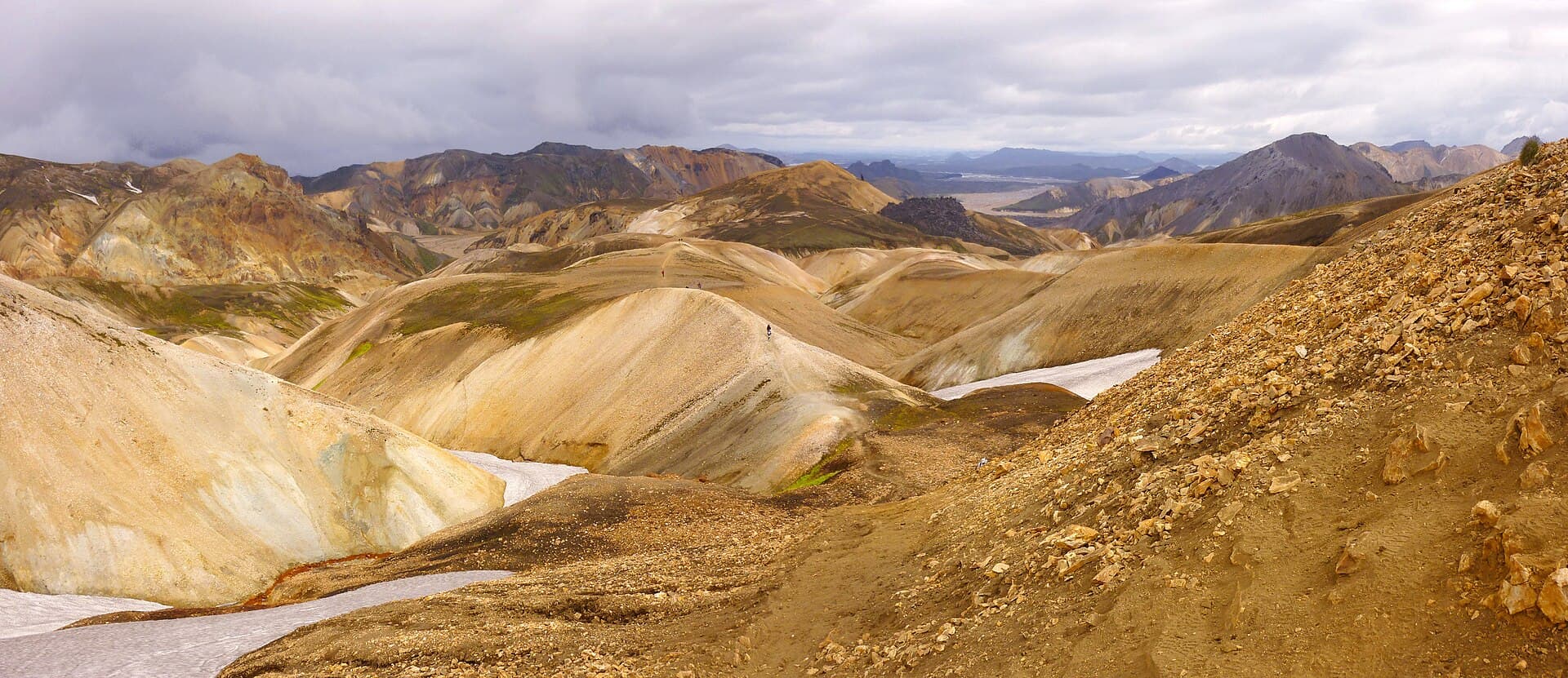
The Laugavegur runs 54 km south from the geothermal valley at Landmannalaugar to the birch woods of Þórsmörk. It is waymarked, it crosses no glacier, it requires no permit, and no Icelandic authority requires or recommends a guide. It is also a route where the weather turns "rapidly and dramatically" in mid-summer on a 1,100 m plateau with no shelter between huts, and where at least three rivers have to be waded. Both of those sentences come from Ferðafélag Íslands — the Icelandic Touring Association, which owns, wardens and books every hut on the route. Treat FÍ as the authority here, because on this trail it is.
The four stages, as FÍ publishes them
FÍ books the route in one direction only. From their Laugavegur FAQ: "We only book huts from north to south, i.e. from Landmannalaugar to Þórsmörk." Plan in that direction or you will not get beds.
| Day | Leg | Distance | Time | Change |
|---|---|---|---|---|
| 1 | Landmannalaugar (600 m) → Hrafntinnusker (1,100 m) | 12 km | 4–5 h | +470 m |
| 2 | Hrafntinnusker → Álftavatn (550 m) | 12 km | 4–5 h | −490 m |
| 3 | Álftavatn → Emstrur/Botnar (465 m) | 17 km | 6–7 h | −40 m |
| 4 | Emstrur → Þórsmörk | 15 km | 6–7 h | −300 m |
Hut capacities, north to south: Landmannalaugar 78, Hrafntinnusker (Höskuldsskáli) 52, Álftavatn 72 across two huts, Hvanngil 60 plus a stable sleeping 20, Emstrur 60 in three huts, Þórsmörk (Skagfjörðsskáli) 73. Hvanngil sits about 5 km past Álftavatn and is the standard way to split the long third day, turning the trek into five stages. Source: FÍ — Laugavegur.
Note the shape of that profile: the hardest day in weather terms is day one, when you are least adjusted and highest. Day three is the longest, and it is the one with the fords.
The season is the hut season
FÍ's own line: "On average one can assume that the trail is open from June 25 to September 15." The individual hut pages give closing dates of 16 September (Hrafntinnusker), 17 September (Álftavatn, Hvanngil) and 18 September (Emstrur). Road access to the northern trailhead averages 20 June to 15 September. Source: FÍ — Hrafntinnusker; FÍ — Landmannalaugar.
Those dates move. FÍ states plainly that "the opening and closing of huts are always subject to prevailing conditions," and the road authority opens the F-roads only when the snowpack allows — Vegagerðin says opening "depends on weather conditions in spring or early summer, with snowpack having the greatest influence."
Outside that window the huts are, in FÍ's words, "closed and locked during the winter time." There is no warden, no ranger, the approach roads are under snow, and the fords are unbridged with nobody to advise on them. FÍ's standard for off-season travel is unambiguous: it suits only "highly skilled hikers, accustomed to extreme conditions and carrying 5 season equipment." That is not a hike with a shorter season. It is a winter expedition.
Even inside the window, expect snow up high. FÍ: "in early summer this area can also be covered with snow." A late-June or September crossing of the high section is worth microspikes.
What actually kills people here
Two mechanisms, both documented by the authorities.
Weather on the high section. FÍ is specific about where: "The weather in this area can change rapidly and dramatically… This is especially true during the first two parts of the trail, from Landmannalaugar up to Hrafntinnusker and then down towards Álftavatn. This part of the trail sees a lot of fog and bad weather." Hrafntinnusker sits at 1,100 m on a snowfield plateau, and there is no shelter between huts. FÍ notes that "anything above 10–12 meters per second can make hiking conditions challenging" — a routine summer wind in Fjallabak. In fog, "visibility can drop quickly, so always follow the trail markers closely." Add unstable ground: FÍ warns of "patches of snow that often melt faster from below, creating thin snow bridges."
The wardens are part of the safety system, and FÍ says so: "Sometimes they might even forbid you to leave the hut until hiking is safe." Their judgement outranks your itinerary.
Neither FÍ, Umhverfisstofnun nor safetravel.is publishes a death toll or incident list for the Hrafntinnusker section, so this guide states no number. Plan around the documented mechanism, not around a statistic.
The rivers. FÍ: "While some rivers on the way have footbridge, at least three rivers have to be waded." The waded crossings named on the route are Grashagakvísl, Bratthálskvísl, Kaldaklofskvísl and Bláfjallakvísl; Ljósá and Fremri-Emstruá are bridged. The one that catches people is the last: "Þröngá can be tricky to ford, especially after rain, as the water level can rise quickly." It is glacier-fed, so it also rises through the afternoon as the day's melt arrives.
ICE-SAR's river doctrine, from safetravel.is, is worth following exactly: cross only if you are "100% sure how to do it"; ask the warden or ranger first; cross in the morning when levels are lowest; go in a linked group of two or three; wear wading shoes, never barefoot; choose a wide slow section over a narrow fast one. If Þröngá is up after rain, wait.
Booking, and the money
There is no permit and no trail fee. What you must hold is a prepaid bed or campsite. FÍ: "Hikers are expected to have confirmed bookings for huts or campsites before starting their trek," and a booking is confirmed only once payment clears in full.
FÍ publishes its 2026 and 2027 tariffs on its terms page — but as images rather than text, so this guide quotes no ISK figure rather than risk a wrong one. Read them there before you budget. Two things the page does state in words: lodging tax is included, and showers are not — "Shower fee not included and must be paid separately," available at Landmannalaugar, Álftavatn, Hvanngil, Emstrur and Þórsmörk.
Cancellation is tiered and unsentimental. Huts: 56 days or more before arrival, 75% back; 55–21 days, 50%; inside 20 days, nothing. Camping: two or more days out, full refund; one day or same-day, nothing. Individual nights inside a package cannot be cancelled separately.
Carry, don't buy: FÍ requires that "when staying in huts in Iceland, you will need to bring with you both a sleeping bag and your own food." The huts provide gas stoves, cookware and cold running water. Hrafntinnusker has no shower. Check-in is 12:00–20:00, check-out 10:00, and you check in with the warden on arrival. Source: FÍ — hut rules; FÍ — what to bring.
Getting to the start
If you drive, you need a parking reservation. Umhverfisstofnun: "It will be necessary to have a reservation if you plan to arrive in Landmannalaugar between 9 AM and 16 PM any day from June 20th to September 14th," booked through Parka. Source: Umhverfisstofnun — Landmannalaugar reservations.
If you take the bus, the 2026 dates differ by operator. Trex runs 19 June to 6 September, departing Reykjavík City Hall at 07:30 and 12:30, at 14,900 ISK one way and 29,800 ISK return. Icelandia's Highland Bus runs to Landmannalaugar 13 June to 20 September from €78, and to Þórsmörk 1 June to 20 September from €74 — and only "when Iceland's F-roads are open."
FÍ recommends the bus for the Þórsmörk end for a blunt reason: "you need to be an experienced driver to cross the rivers" on that approach.
Before you walk
Lodge a travel plan with ICE-SAR at safetravel.is — voluntary, not a permit, and the thing that tells searchers where to look. Umhverfisstofnun asks hikers "to log their itinerary in SafeTravel when planning longer hikes."
Carry navigation. FÍ requires "some kind of navigation equipment (GPS, map and compass) and wind- and waterproof clothing" on every hike regardless of season. Check the forecast at vedur.is and blika.is every morning; ICE-SAR's instruction is "Check weather every day – even twice a day. This is Iceland and sudden weather changes can be drastic – even in summer."
Two more from the reserve itself: stay off the rock, because "the rock is very loose, and all climbing is dangerous," and take care around the hot ground — "avoid stepping in hot mud or water." Source: Umhverfisstofnun — Fjallabak hiking trails.
Emergency number is 112. By satellite, 00 354 570 2112. safetravel.is currently also posts 599-0112 as an alternative for anyone unable to reach 112 after the 2G/3G shutdown — worth saving, because coverage on this route is patchy.
14 Sources
- fi.isFerðafélag Íslands — Laugavegur trail
- fi.isFerðafélag Íslands — Hrafntinnusker (Höskuldsskáli) hut
- fi.isFerðafélag Íslands — Landmannalaugar hut
- fi.isFerðafélag Íslands — Terms and prices
- fi.isFerðafélag Íslands — Laugavegur FAQ
- fi.isFerðafélag Íslands — Hut rules
- fi.isFerðafélag Íslands — What to bring
- ust.isUmhverfisstofnun — Fjallabak Nature Reserve, hiking trails
- ust.isUmhverfisstofnun — Landmannalaugar parking reservations
- safetravel.issafetravel.is (ICE-SAR) — Hiking and trekking
- safetravel.issafetravel.is (ICE-SAR) — Travel plans
- vegagerdin.isVegagerðin — Mountain roads
- trex.isTrex — Landmannalaugar bus
- icelandia.comIcelandia — Highland Bus