
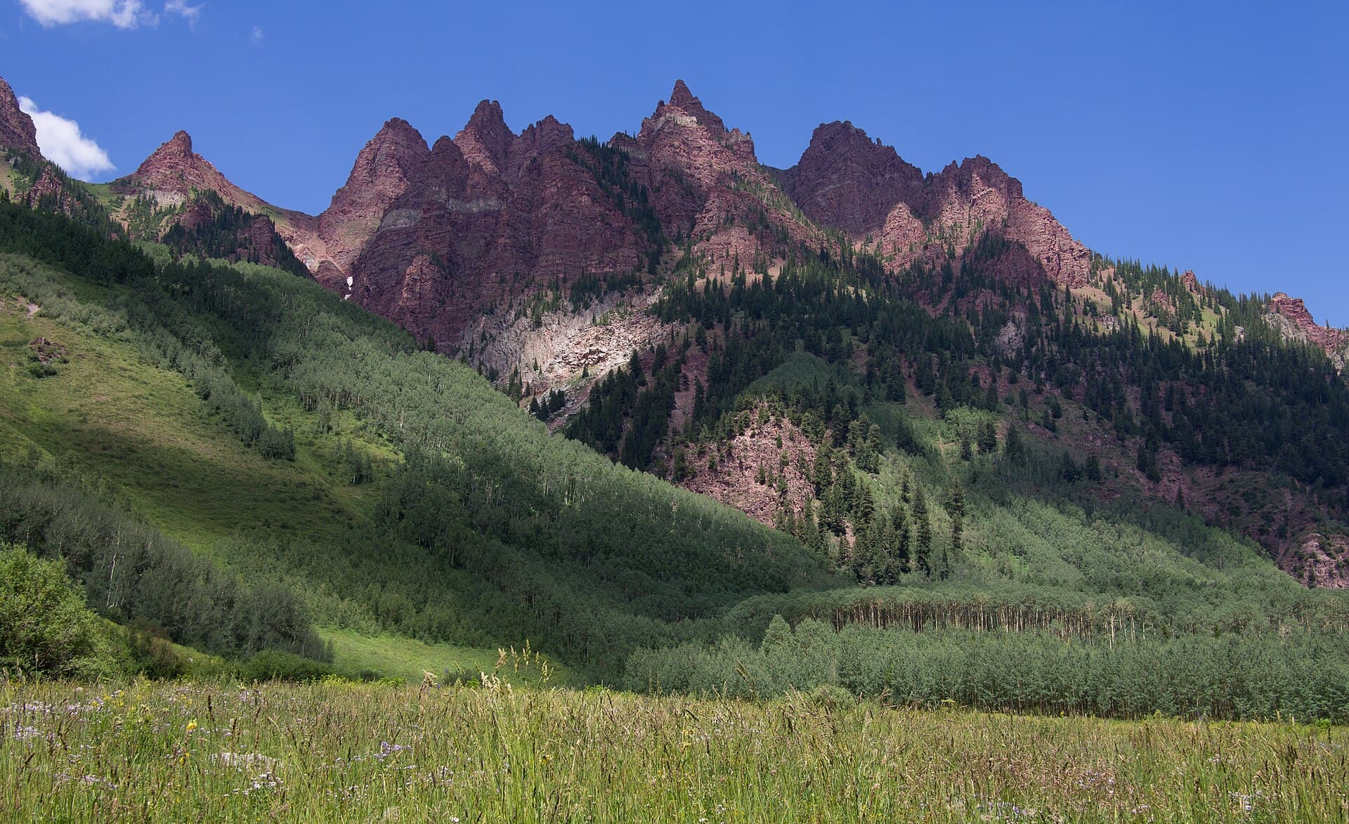
On a Sunday afternoon in late July 2026, lightning struck near the summit of Mount Blue Sky, the 14,265-foot peak whose paved road — the highest in America — ends within steps of the top. Levi Strobel, a 15-year-old hiker, was killed. A second minor was seriously injured, and three adults were also hurt (Backpacker).
Mount Blue Sky was two months into a celebrated comeback. Its Scenic Byway, which normally draws more than 100,000 visitors a year, had been closed for repairs through the entire 2025 season; it reopened on May 22, 2026 with a recreation.gov reservation system and a summit welcome site newly operated by Denver Parks & Recreation (Colorado Sun). Reservations, pavement, staff — a managed, ticketed mountain. None of it registers with a storm cell. If the accident teaches one thing without needing any commentary, it is this: road access buys no exemption from Colorado's afternoon lightning regime. The regime applies to everyone above treeline, however they got there.
That regime is not a weather tip. It is a schedule — the closest thing the Colorado high country has to a law — and every 14er day that ends well is built backwards from it.
The regime: 5,350 flashes a day
Per the National Weather Service, on any given day in July there are 5,350 lightning flashes in Colorado, and the agency's framing allows no fine print: "no place outside is safe from lightning" (KUNC). The engine is monsoon-season convection. Clear, calm mornings feed heat and moisture into building cloud, and the first cells often fire over the high peaks by midday — earlier than the phrase "afternoon thunderstorms" suggests, and directly above the terrain a 14er hiker occupies. That timing, in the words of Colorado's mountain-weather forecasters, "necessitates a very early start to safely summit and descend" (OpenSnow). Storm frequency ramps up in early July and eases around Labor Day.
What makes the 14ers a special case is exposure without exits. The upper hours of every route are open tundra and bare rock; there is no shelter to reach, so the only mitigation is to not be there — and descending takes hours you must have banked in advance. Nor is the sky a hypothetical on these specific mountains: on Longs Peak, where the NPS warns that winter-like conditions occur year-round, the non-fall fatality causes recorded since 1915 include 7 hypothermia deaths, 3 lightning and 3 exhaustion/exposure (Rocky Mountain Hiking Trails; NPS). Weather is a first-order killer on the "walk-up" peaks, not a footnote to the scrambling.
Continue reading Your first 14er: Quandary, Bierstadt, and the acclimatization math nobody does →
Build the day backwards
The operating number is not a start time. It is a turnaround: on the summit by late morning, heading down by noon at the latest — then derive the alarm clock from the length of the route. Breckenridge's official guidance for Quandary Peak puts it in capitals: hikers are "STRONGLY encouraged to start their hikes early in the morning to avoid dangerous afternoon thunderstorms" (GoBreck). Here is the arithmetic on three benchmark peaks:
| Peak (standard route) | Round trip | Typical day | The start that clears noon |
|---|---|---|---|
| Quandary Peak — East Ridge, Class 1 | 6.75 mi, 3,450 ft | ~6 h average | On the trail by 5-6 a.m. |
| Mount Bierstadt — West Slopes, Class 2 | 7.0 mi, 2,850 ft | Comparable: "7 miles and nearly 3,000 feet in a low-oxygen environment" | First light |
| Longs Peak — Keyhole Route, Class 3 | ~16 mi, 4,875 ft | 10-18 h | 12:00-2:00 a.m. — the guides' standard |
(Route data: The Next Summit — Quandary, Bierstadt; day lengths: GoBreck, KMAC Guides.)
The Longs row explains a Colorado peculiarity: the alpine start without the alpine hut. In the Alps a midnight departure leaves from a refuge high on the mountain; on Longs, guided parties leave the trailhead parking lot between midnight and 2:00 a.m., because 10 to 18 hours of route have to fit in front of the same midday deadline (KMAC Guides). A guided Keyhole day runs $650 solo or $1,050 for two — and what that buys, above all, is timing discipline.
Two caveats keep the table honest:
- The forecast and the sky outrank any clock time (OpenSnow). 5,350 flashes a day is a statewide July average, spread across quiet days and violent ones. Towering cumulus at 9 a.m. means the schedule has already failed — turn around. A genuinely dry, stable forecast relaxes it. Noon is the default deadline, not a guarantee of safety.
- A start time you can't hold is not a start time. Parties that top out at 1 p.m. rarely planned to; they planned for 10:30 and moved slower than planned. Why they moved slower is the next section.
One more schedule worth reading correctly: Quandary's managed parking runs 5 a.m. to 3 p.m. — $30 on weekdays, $55 Friday through Sunday and holidays — and becomes free, first-come, after 3 p.m. (Summit County). The free-after-3 window is for an evening stroll in the valley, not a discount summit start. And note the season's dates: paid management runs June 13 to September 13, 2026 — which is, almost to the week, the lightning season. The county meters the mountain during precisely the weeks the sky does.
The overlay: you start where Alpine huts end
The lightning clock would be a simple discipline if hikers were at their best at 5 a.m. Many are not, and the reason is Colorado's other defining number: the trailheads themselves sit at altitudes most ranges reserve for high camps. Quandary's trailhead is around 10,800 feet — summit elevation minus route gain (The Next Summit; GoBreck) — and Bierstadt's is the top of Guanella Pass, a paved road pass two miles above sea level (The Next Summit).
The medical numbers: altitude sickness affects roughly 20% of people who go above 8,000 feet and 40% of those above 10,000 feet unacclimatized — nearly half of sea-level arrivals, at exactly trailhead elevation. Standard prevention is a staged ascent: an extra acclimation day per 1,000 feet gained above 10,000, plus a rest day per 3,000; "climb high, sleep low"; and the only actual cure is descent (The Next Summit).
Now overlay the two clocks and the classic weekend plan collapses. Land in Denver on Friday, sleep short in a trailhead town, summit Saturday off a 4 a.m. alarm: that is the AMS-maximizing itinerary, executed at the exact hour the lightning schedule demands your fastest, sharpest self. And unlike the Alps, there is no hut system to stage the ascent for you — in Colorado, acclimatization happens in the valley towns (Denver, Estes Park, Breckenridge, Leadville) before a one-day push, or it does not happen at all (The Next Summit).
The two hazards compound rather than add. AMS at 13,000 feet rarely kills by itself; it slows you and dulls you. A party moving at altitude-sick pace summits at 1 p.m. instead of 10:30 — and 1 p.m. above treeline in July is the one place on the schedule you must not be. In Colorado, the headache is a timing problem before it is a medical one.
September: the smart-money window
The monsoon has edges. Storm frequency ramps up in early July and eases around Labor Day, "making September often a great month" to summit (OpenSnow). The snow-free season overall runs roughly late June through September; July and August maximize accessibility and lightning at the same time; September trades storms away for shorter days and the first winter weather. Month by month:
| Month | Lightning picture | Season status (2026) | Verdict |
|---|---|---|---|
| October-May | Lightning is not the main hazard — winter is | High country snowbound; the NPS warns winter-like conditions occur on Longs year-round | A mountaineering season, not a hiking one |
| Late June | The monsoon has not ramped up yet | Snow-free season opening, with lingering early-season snow; Quandary managed parking starts June 13 | Good storm odds — if the snow has gone |
| July | The peak: 5,350 flashes/day statewide, first cells over the summits by midday; the Blue Sky strike fell in late July | Everything open; peak demand | Predawn starts, down by noon — no exceptions |
| August | The monsoon holds through the month | Everything open | Same discipline as July |
| September | Eases around Labor Day, then fades | Days shorten and the first winter storms arrive; Quandary's managed season ends September 13, while the Maroon Bells shuttle runs to October 18 and RMNP's Bear Lake timed entry to October 19 | The smart-money window — trade flashes for cold and shorter days |
(Access dates: Summit County, RFTA, NPS.)
Read the September row's third column closely, because it is what makes the window practical: the access infrastructure outlives the storm season. The shuttles and reservation systems run deep into October, weeks after the monsoon has faded — so September is not an off-season improvisation but a fully supported month with the region's best sky. The price is honest: shorter days tighten the same turnaround math, and an early snowstorm can end the season overnight.
The rules, compressed
- Build the day backwards from noon. Off the summit and descending by noon at the latest; the start time follows from the route's length, not from comfort. On Longs, that means midnight.
- The sky outranks the clock. Forecast and sky-reading trump any fixed time — clouds building at 9 a.m. end the day early, and no start time makes a bad forecast safe.
- Road access is not shelter. The Blue Sky parking area sits at the same 14,265 feet as the tundra around it. Reservations and pavement change how you arrive, not what the sky does.
- Arrive acclimatized. Roughly 40% of unacclimatized visitors get altitude sickness above 10,000 feet — trailhead height. "Land Friday, summit Saturday" is the plan the numbers rate worst; nights in a mountain town first are part of the route, because slow is late, and late is exposed.
- If your dates are flexible, take September. The monsoon fades after Labor Day while shuttles and timed entry run into October. Trade flashes for cold.
Colorado's 14ers are unusually generous in most currencies — no summit permits on the public peaks, a near-zero gear barrier, trailheads within a morning's drive of a hub airport. The range charges in exactly one currency instead: timing. The convection does not negotiate, and — as late July 2026 showed at the top of a paved road — it does not check how you got there. Summit by noon, or come back in September.
14 Sources
- backpacker.comBackpacker — Lightning strike on Colorado fourteener kills teenage hiker, injures four others (2026)
- coloradosun.comColorado Sun — Road to Mount Blue Sky set to reopen as Denver Parks takes over welcome site (2026)
- kunc.orgKUNC — At the peak of hiking season, Colorado sees 5,350 lightning strikes a day
- opensnow.comOpenSnow — Expert tips: avoiding thunderstorms on Colorado fourteeners
- gobreck.comGoBreck — Quandary Peak hiking guide
- summitcountyco.govSummit County — Quandary Peak & McCullough Gulch managed access
- thenextsummit.orgThe Next Summit — How to prevent altitude sickness at 14,000 feet
- thenextsummit.orgThe Next Summit — Hiking Quandary Peak
- thenextsummit.orgThe Next Summit — Hiking Mount Bierstadt
- kmacguides.comKMAC Guides — Climb Longs Peak
- nps.govNPS — Longs Peak / Keyhole Route
- rockymountainhikingtrails.blogspot.comRocky Mountain Hiking Trails — A statistical analysis of fatalities on Longs Peak
- rfta.comRFTA — Maroon Bells shuttle
- nps.govNPS — Rocky Mountain National Park announces 2026 timed entry reservation system