The youngest granite on Earth, racing out of the ground
Quaternary uplift of the Hida Range (Japanese island-arc orogeny)plutons 10–0.8 Ma (Kurobegawa youngest phase ~0.8 Ma; Takidani ~1.4 Ma); Yari-Hotaka caldera tuff ~1.76 Ma; rapid uplift Quaternary and ongoingPacific and Philippine Sea plates subducting beneath the Eurasian (Amurian) margin — east–west compression of the Honshu arc🌋 andesitic stratovolcano (Yakedake) rising within a rapidly uplifting non-volcanic range — Japan Meteorological Agency (JMA): Yakedake is ACTIVE — Volcanic Alert Level 1, 'potential for increased activity' (raised to Level 2 on 25 January 2026 during a seismic swarm, lowered back to Level 1 at 14:00 on 4 March 2026). It is one of Japan's 111 active volcanoes and among the 50 JMA monitors continuously.
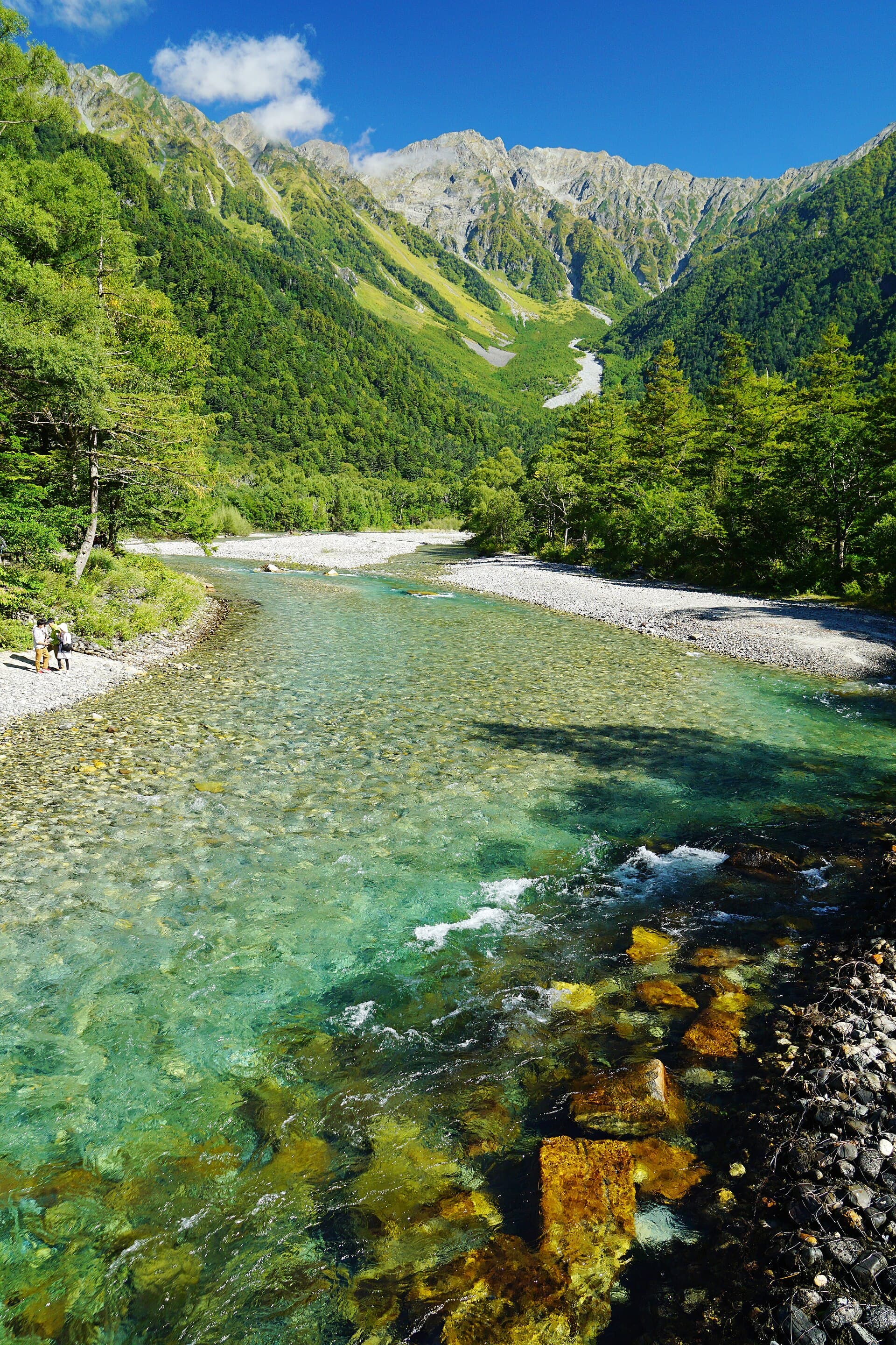
Kamikochi and the Hotaka skyline: Quaternary uplift, young granite, welded tuff, and glacial carving in the Hida Range.
Photo by 663highland. · CC BY 2.5 / CC BY-SA 3.0 / GFDL · source
The Hida Range — the Northern Japan Alps — is not the wreckage of a continental collision like the European Alps. It is an island arc being squeezed. Japan sits above two subducting slabs, the Pacific and Philippine Sea plates, and the resulting east–west compression, working on a crust already softened by arc magmatism, has driven one of the fastest episodes of mountain-building on the planet: a wall of 3,000-metre peaks raised almost entirely within the Quaternary.
The proof is written in granite. In 1992, Harayama reported in Geology that the Takidani Granodiorite — exposed in the gorge between Yarigatake and the Hotaka peaks — was about 1.4 million years old, the youngest exposed pluton then known on Earth. In 2013, Ito and colleagues (Scientific Reports) dated the nearby Kurobegawa Granite and found intrusive phases as young as about 0.8 million years — the youngest known exposed granite on the planet. Granite crystallizes kilometres underground; to be standing on it today, the range must have been uplifted and stripped of its cover at rates measured in millimetres per year, geologically sprinting.
The Hotaka skyline tells the same story another way. The summits around Oku-Hotaka-dake (3,190 m, Japan's third-highest peak) are carved from the Hotaka Andesite: a welded-tuff sheet locally 1,500 m thick that filled an 18 × 6 km caldera formed by a colossal explosive eruption about 1.76 million years ago. Rock that erupted into a collapsing caldera — a hole in the ground — now forms some of the highest summits in Japan, hoisted skyward by the same uplift that exhumed the granites, then sharpened into arêtes and cirques by ice-age glaciers. And the ice is not entirely gone: in 2012 the Japanese Society of Snow and Ice recognized flowing ice bodies on Tsurugi and Tateyama — Gozenzawa, Sannomado and Komado — as Japan's first confirmed active glaciers (Fukui & Iida 2012).
One volcano in the range is still working. Yakedake (2,455 m), rising directly above Kamikōchi, is the Northern Alps' only active volcano — one of Japan's 111 officially active volcanoes and among the 50 the Japan Meteorological Agency monitors around the clock. On 6 June 1915 it erupted from a kilometre-long fissure, and the resulting mudflow dammed the Azusa River to create Taishō Pond, with its ghost forest of drowned trees. Frequent phreatic eruptions followed through the 20th century, most recently in 1962–63, and a non-eruptive hydrothermal explosion near Nakanoyu killed four road workers on 11 February 1995. After a seismic swarm in January 2026 briefly pushed the alert to Level 2, JMA returned Yakedake to Volcanic Alert Level 1 ('potential for increased activity') on 4 March 2026 — a reminder that the steam on its summit is not decoration.
What you can see on the trail
Taishō Pond and its drowned ghost forest — a landscape made in 1915
📍 Kamikōchi valley walk, between Taishō-ike bus stop and Kappa Bridge
When Yakedake erupted on 6 June 1915, a mudflow dammed the Azusa River overnight and flooded this stand of trees. The bare trunks still standing in the water, with the steaming volcano reflected behind them, are a one-photo summary of the valley's geology.
Yakedake's steaming summit fumaroles
📍 Yakedake trail from Kamikōchi (Nishi-Hotaka side) or the Nakanoyu trailhead; visible from all over the Kamikōchi valley
Sulfurous steam vents near the summit crater mark the Northern Alps' only active volcano, held at JMA Alert Level 1. It is one of the few places in Japan where a day-hike circles the rim of live volcanic plumbing — check JMA's level before climbing.
The Hotaka wall — a supereruption deposit hoisted 3 km into the sky
📍 From Kappa Bridge in Kamikōchi, and up close on the Karasawa route to Oku-Hotaka-dake
The great cliffs above the Azusa River are welded tuff that filled a collapsing caldera about 1.76 million years ago. That caldera fill now stands at 3,190 m — direct, visible evidence of some of the fastest uplift on Earth.
Karasawa Cirque — an ice-age amphitheatre in the tuff
📍 Karasawa hut basin, the standard overnight on the Hotaka ascent from Kamikōchi
The huge bowl holding the Karasawa huts was quarried by Pleistocene glaciers out of the Hotaka Andesite. Japan's only confirmed active glaciers survive today a little further north, on Tsurugi and Tateyama — recognized only in 2012.
Fun fact
Until 2012 Japan was thought to have no glaciers at all — then surveys showed ice bodies on Tsurugi and Tateyama (Gozenzawa, Sannomado, Komado) over 30 m thick were flowing up to ~32 cm per month, and the country gained its first officially recognized glaciers, right here in the Northern Alps.
Rocks: welded andesitic-dacitic tuff (Hotaka Andesite, ~1.76 Ma caldera fill, locally 1,500 m thick) · granodiorite (Takidani, ~1.4 Ma — Harayama 1992) · granite (Kurobegawa, youngest phase ~0.8 Ma — Earth's youngest known exposed granite) · andesite lavas and phreatic-eruption deposits (Yakedake) · glacial and fluvial valley fill (Kamikōchi basin)