Africa's sleeping giant on the shoulder of a splitting continent
East African Rift volcanism (North Tanzanian Divergence)~2.5 Ma (Shira) → ~165–195 ka (youngest dated Kibo activity, K–Ar); rifting ongoingNubian (African) and Somali plates diverging along the eastern branch of the East African Rift🌋 stratovolcano massif with three cones (Shira, Mawenzi, Kibo) — Kibo is DORMANT, not extinct — per the Smithsonian Global Volcanism Program (the standard reference; Tanzania operates no volcano alert-level system): no confirmed historical eruptions, but active fumaroles persist in the inner Reusch Crater / Ash Pit. Shira and Mawenzi are extinct and deeply eroded.
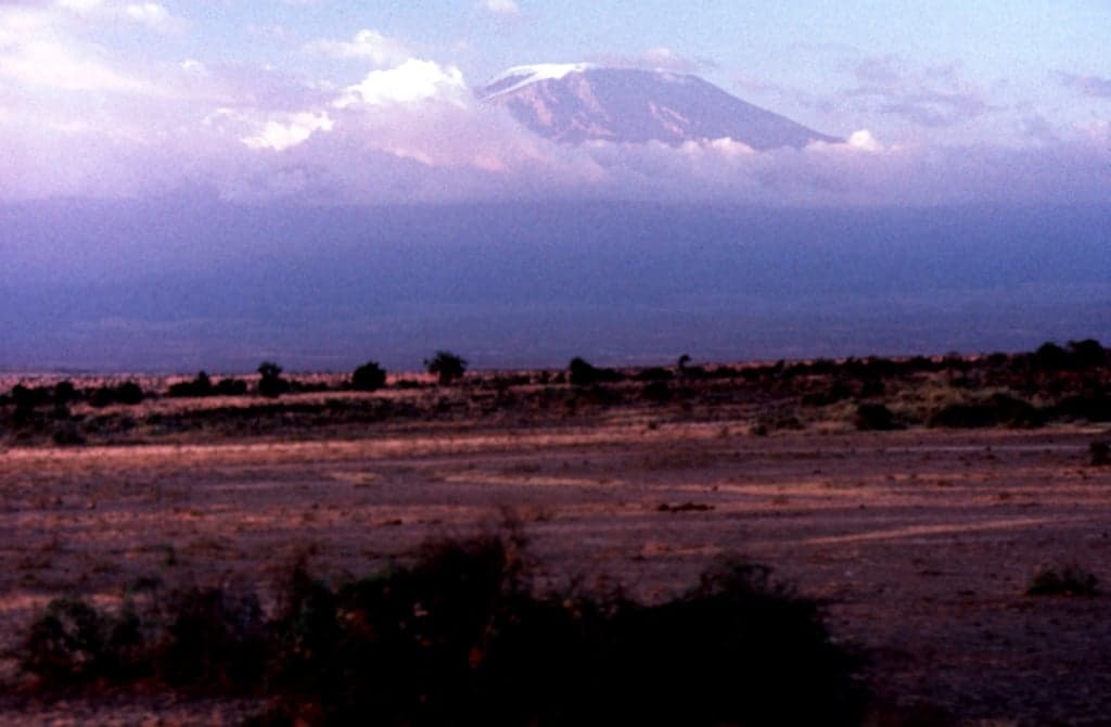
Kilimanjaro sits on the East African Rift system; the broad Kibo summit profile records a large caldera.
Photo by Tom Jorstad, Smithsonian Institution. · CC0 Public Domain Dedication · source
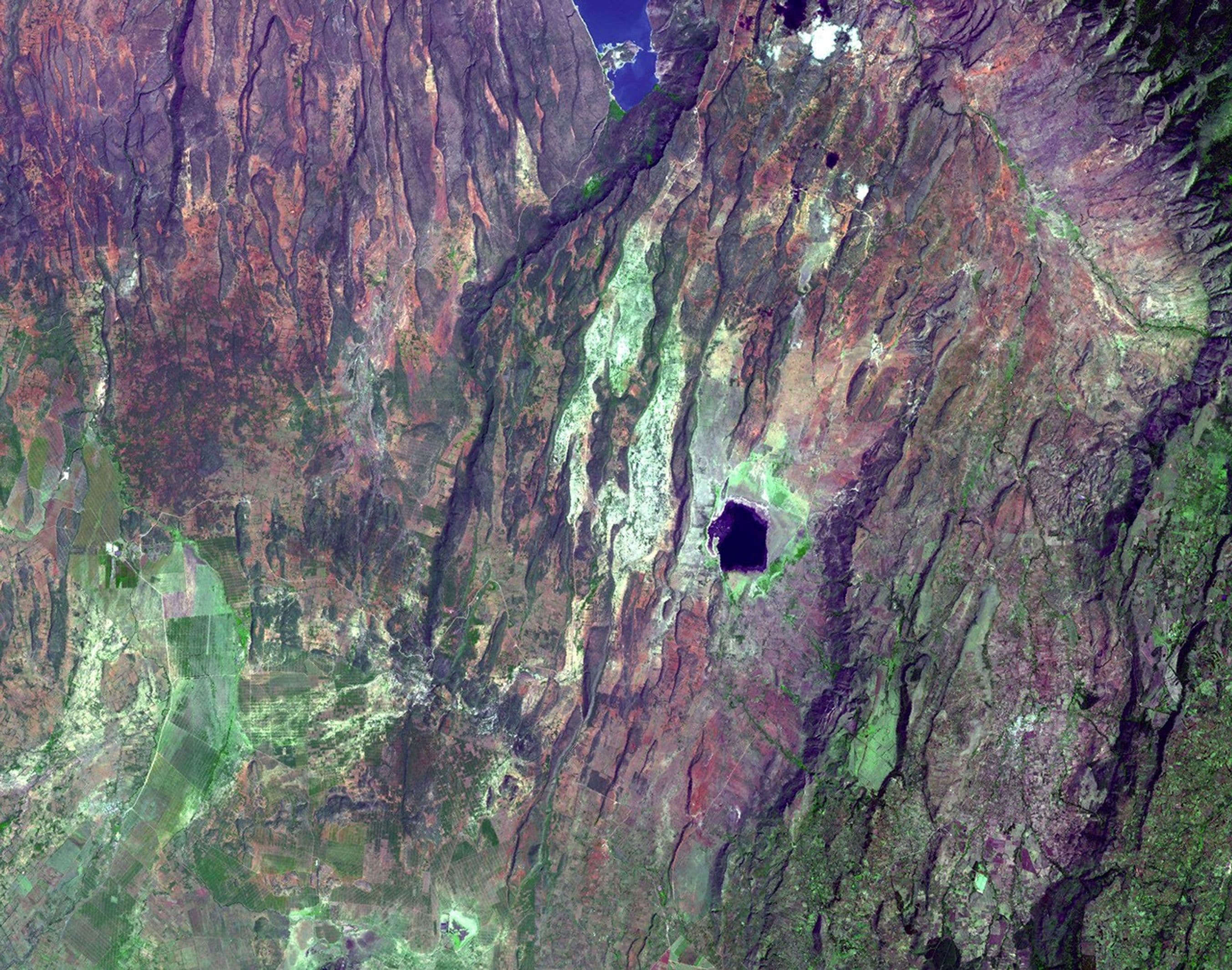
Kilimanjaro exists because Africa is slowly tearing itself apart. The mountain stands in the North Tanzanian Divergence, the southern splay of the East African Rift's eastern branch, where the crust between the Nubian and Somali plates is being stretched and broken. Deep faults opened pathways for magma, and from a rifted plain little more than a kilometre high grew a volcanic massif whose summit, Uhuru Peak, now stands at 5,895 m — the highest point in Africa.
It is not one volcano but three. K–Ar dating (Nonnotte et al. 2008, Journal of Volcanology and Geothermal Research) shows the story began about 2.5 million years ago at Shira, the westernmost centre, whose main phases ended around 1.9 Ma with a collapse of the northern part of the edifice. Activity then shifted east to the twin centres of Mawenzi and Kibo, both born around 1 Ma. Mawenzi's youngest dated rocks — about 492,000 and 448,000 years old — mark the end of its construction; erosion has since stripped it to a shattered core of dikes and spires. Kibo, the youngest cone, kept erupting: its youngest dated activity gives K–Ar ages of about 165,000 and 195,000 years, around the time the present summit crater took shape.
That makes Kibo dormant — emphatically not extinct. The Smithsonian Global Volcanism Program, the standard international reference (Tanzania operates no volcano-observatory alert system), lists Kilimanjaro with no confirmed historical eruptions but with continuing fumarolic activity in the summit's Reusch Crater. Climbers who drop into the crater can smell it: sulfurous gases still seep from vents around the inner Ash Pit, activity first reported by H. W. Tilman in 1933 and plainly visible today as yellow sulfur crusts. Shira and Mawenzi are dead; Kibo merely sleeps.
The summit's other story is disappearing in plain sight. Ice cover mapped at 12.06 km² in 1912 had shrunk to 1.85 km² by 2007 — an 85% loss — and a quarter of the ice present in 2000 was gone within just seven years (Thompson et al. 2009, PNAS). The same study projected that, if trends continued, the ice fields that crown Africa could vanish within decades. Trekkers today walk past the ice cliffs of the Furtwängler Glacier and the Northern Ice Field as witnesses to one of the most photographed climate signals on Earth.
What you can see on the trail
Shira Plateau — the eroded stump of the oldest cone
📍 Day 2 of the Lemosho and Machame routes, crossing the plateau toward Shira Camp
The strange flatness underfoot is the filled and eroded remains of the ~2.5-million-year-old Shira volcano, Kilimanjaro's first cone, decapitated by collapse and buried by younger Kibo lavas. Its western rim survives as the Shira Ridge on the skyline.
Lava Tower — a free-standing volcanic monolith at ~4,600 m
📍 Machame and Lemosho routes, the acclimatization high point between Shira and Barranco
This tower of solidified lava is an erosional remnant of Kibo's flank plumbing — harder rock left standing as softer material weathered away. Trekkers eat lunch at the foot of a fossil conduit.
Mawenzi's shattered spires — a dissected volcano's heart
📍 From the Saddle between Kibo and Mawenzi, on the Marangu and Rongai summit approaches
Mawenzi stopped erupting roughly 450,000 years ago; glaciers and frost then stripped away its outer cone, exposing the jagged swarm of dikes that once fed it. You are looking at the inside of a volcano.
Reusch Crater fumaroles and the Furtwängler Glacier
📍 Uhuru Peak crater rim and the Crater Camp / Ash Pit excursion
Sulfur-stained vents around the inner Ash Pit still emit gases — the direct evidence that Kibo is dormant, not dead — while the nearby ice walls of the Furtwängler Glacier are remnants of a cover that has lost 85% of its area since 1912 (Thompson et al. 2009).
Fun fact
At the roof of Africa you can smell an active volcano: sulfurous fumaroles in the Reusch Crater, first reported by climber H. W. Tilman in 1933 (disputed at the time, since vindicated), still vent today — Kibo is asleep, not extinct.
Rocks: phonolite and trachyte lavas (Kibo summit sequences) · trachyandesite and basaltic lavas (older flank and cone sequences) · dike-intruded eroded volcanic core (Mawenzi) · volcanic ash, tephra and sulfur deposits (Reusch Crater / Ash Pit)