Himalayan orogeny (India–Asia collision)onset ~59–50 Ma (classic estimate ~55–50 Ma); ongoingIndian Plate colliding with the Eurasian Plate after closure of the Neo-Tethys Ocean🌋 none — No volcanoes — the Smithsonian Institution's Global Volcanism Program lists no Holocene volcanoes in Nepal. The Himalaya is a continent–continent collision belt without active subduction volcanism; its granites are ancient crustal melts, long solidified.
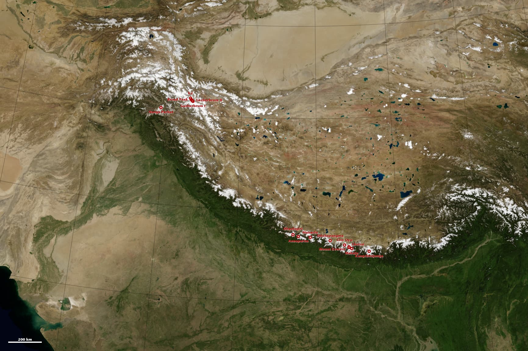
The India-Asia collision: white 8,000-meter peaks along the Himalaya and Karakoram, with the high Tibetan Plateau behind.
NASA Earth Observatory image by Robert Simmon, using Blue Marble and GTOPO30 data. · NASA media use guidelines · source
The summit of Everest — 8,848.86 m by the 2020 Nepal–China joint survey, a figure that includes the summit snowcap (the bedrock beneath was measured at about 8,844 m in 2005) — is made of marine limestone. The top of the mountain is capped by the Qomolangma Formation, a Middle Ordovician limestone (roughly 470–460 million years old) laid down in a warm, shallow arm of the Tethys Ocean. Japanese geologist Harutaka Sakai and colleagues identified skeletal fragments of crinoids (sea lilies), trilobites and ostracods in samples collected within metres of the summit. Every climber who has ever stood on the highest point on Earth was standing on an ancient tropical seafloor — a fact so striking that the IUGS lists the Ordovician rocks of Mount Everest among the world's geological heritage sites.
How seafloor got to the roof of the world is the story of the greatest collision in recent Earth history. After breaking away from Gondwana, India raced north across the closing Tethys Ocean — its abrupt slowdown in plate speed is one of the classic lines of evidence for first contact with Asia. Current research places the onset of collision between about 59 and 50 million years ago (a major 2016 review in Earth-Science Reviews argues for ~59 Ma; the classic figure is ~55–50 Ma), and the last marine seaways vanished from the Himalaya by around 50–45 million years ago. With nowhere left to go, India's leading edge — including that Ordovician shelf limestone — was scraped off, stacked up and pushed skyward.
Everest itself is a three-layer cake separated by low-angle faults. The summit limestone rides on top, essentially unmetamorphosed. Below the Qomolangma Detachment lies the Yellow Band and North Col Formation — Cambrian limestones of about 510 Ma cooked into pale marbles and calc-silicates during the Miocene. And the base of the massif is invaded by young leucogranites: crystallized crustal melts dated at 21–20 Ma on Everest, 19–18 Ma on Nuptse and ~15.6–15.4 Ma in the Rongbuk valley, which record hot mid-crustal rock flowing south and being extruded beneath the summit rocks. The paradox of Everest is that its oldest, coldest rocks sit on top of its youngest and hottest.
The collision has not finished. GPS geodesy shows about 2 cm per year of shortening being absorbed across the Nepal Himalaya — strain that is released in great earthquakes like Gorkha 2015. Everest itself is rising at roughly 2 mm per year according to recent GPS, about double its long-term average: a 2024 Nature Geoscience study attributes part of the extra uplift to isostatic rebound after the Arun River captured a neighbouring drainage about 89,000 years ago and began carving out the landscape faster, an event calculated to have added some 15–50 m to the peak. The seafloor on the roof of the world is still on its way up.
What you can see on the trail
Everest's summit stratigraphy — grey marine limestone over the pale Yellow Band
📍 Kala Patthar (5,545 m), the classic sunrise viewpoint on the Everest Base Camp trek
The summit pyramid shows its layers to the naked eye: the grey cap is Ordovician seafloor limestone, and the pale stripe cutting across below it is the Yellow Band — older limestone metamorphosed to marble. The faint line between them is the Qomolangma Detachment, a fault that let seafloor ride up on top of the mountain.
The Nuptse leucogranite — a wall of 19–18-million-year-old crustal melt
📍 The EBC trail between Lobuche and Gorak Shep, facing Nuptse's enormous south-west walls
Those shining pale-white rock faces are leucogranite: granite formed when the over-thickened crust partially melted during the collision, dated at 19–18 Ma on Nuptse. The dark streaks are older metamorphic rock the granite sheets intruded — a frozen cross-section of a mountain range's molten core.
Ammonite fossils (shaligrams) from the Tethys seafloor
📍 Kali Gandaki riverbed near Kagbeni and the slopes toward Muktinath, on the Annapurna Circuit
Black stones in the riverbed split open to reveal spiral ammonites — Jurassic to Early Cretaceous sea creatures from the Spiti Shale, deposited on the Tethys ocean floor roughly 166–140 million years ago and now lying at over 2,800 m. Hindus venerate them as shaligrams, sacred forms of Vishnu.
The Kali Gandaki gorge — a river older than the mountains
📍 The trail between Tatopani and Ghasa, with Dhaulagiri (8,167 m) and Annapurna I (8,091 m) rising on either side
The Kali Gandaki is an antecedent river: it was already flowing south before the high Himalaya rose, and it kept sawing downward as the two 8,000-metre giants grew around it. The result is one of the deepest valleys on Earth, cut clean through the axis of the range.
Fun fact
Fossil fragments of sea lilies, trilobites and ostracods have been identified in limestone collected within metres of Everest's summit. The highest rock on Earth — the bedrock just beneath the official 8,848.86 m snow-and-ice summit — formed on a tropical seafloor about 470 million years ago.
Rocks: Ordovician marine limestone (Qomolangma Formation, summit) · marble and calc-silicate (Yellow Band / North Col Formation) · Miocene leucogranite (Everest, Nuptse, Rongbuk) · Greater Himalayan gneiss and schist · Jurassic–Early Cretaceous black shale with ammonites (Spiti Shale, Kali Gandaki)