Earth's highest active volcano, above the driest nonpolar desert
Andean orogeny — Central Volcanic Zone arcPleistocene–Holocene edifice; last confirmed eruption 750 CE ± 250 (subduction ongoing)Nazca plate subducting beneath the South American plate over some of Earth's thickest continental crust (~70 km)🌋 massive compound stratovolcano complex (largely buried caldera, lava domes, pyroclastic cones) — ACTIVE per the Smithsonian Global Volcanism Program, which calls it "the world's highest active volcano" on the basis of its Holocene eruption record and persistent fumarolic activity; no confirmed historical eruptions. SEGEMAR's OAVV catalogues it as "potencialmente activo" (potentially active) and includes it in Argentina's volcanic risk ranking in the lowest-risk group (RVR 16–28). Per GVP, the highest volcano with documented historical eruptions is Llullaillaco (last erupted 1877).
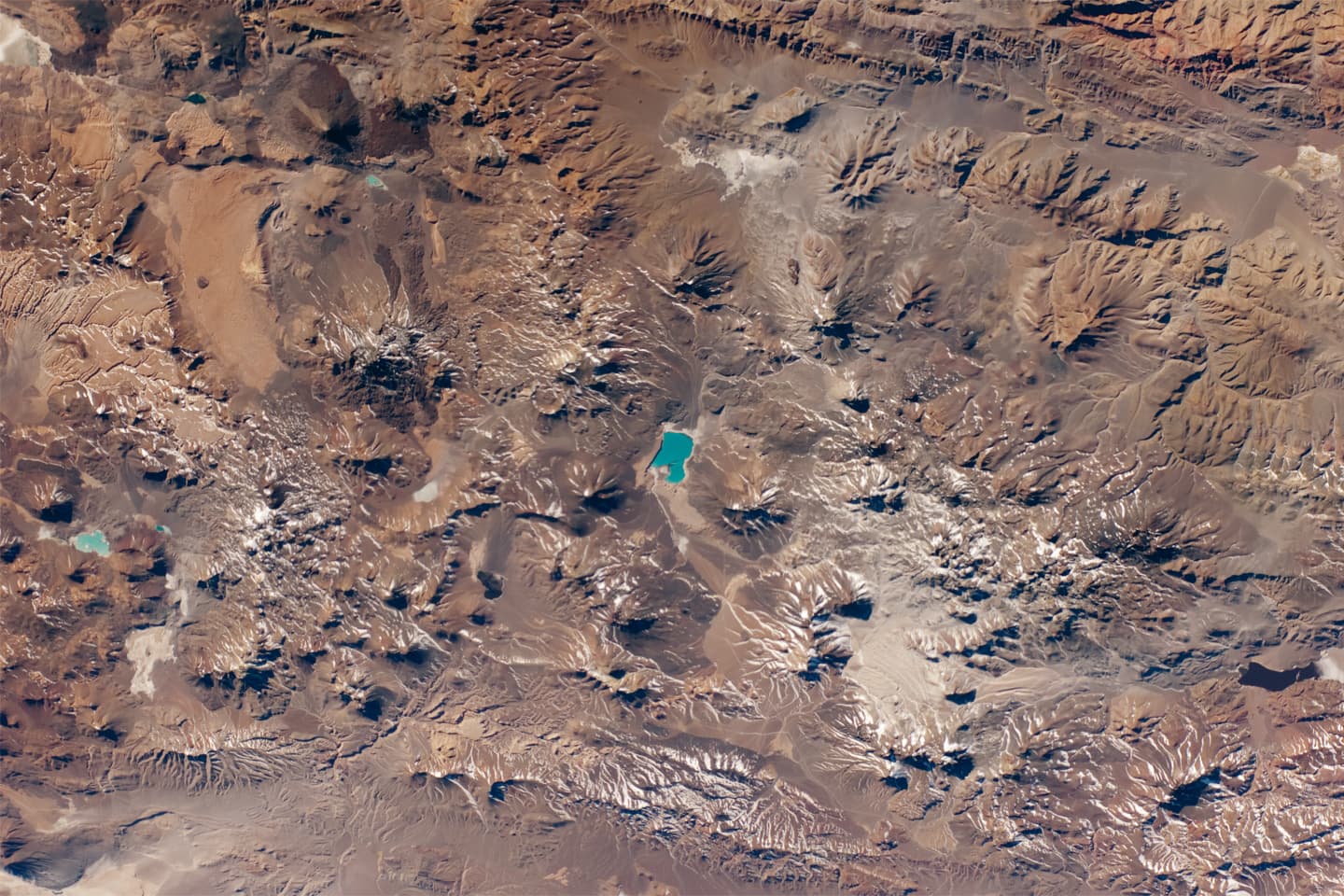
Central Andes volcanic landscape near Ojos del Salado: young cones, lava flows, tuff sheets, and closed high-desert basins.
NASA Earth Observatory; ISS Crew Earth Observations / NASA-JSC. · NASA media use guidelines · source
Start with the superlative, stated precisely. The Smithsonian Global Volcanism Program calls Nevados Ojos del Salado "the world's highest active volcano" — 6,879 m in the GVP database, 6,893 m in the surveys most expeditions use — which also makes it the highest volcano on Earth of any kind, and the highest summit in Chile. The fine print matters: Ojos has no confirmed eruption in written history, and the highest volcano with documented historical eruptions is its neighbour Llullaillaco, which last erupted in 1877 (GVP). Ojos earns "active" the geological way: a confirmed eruption around 750 CE ± 250 years, dated by tephrochronology, and fumaroles that still breathe today.
Its address explains its stature. Ojos rises at the southern end of the Central Volcanic Zone, where the Nazca plate dives beneath South America over some of Earth's thickest continental crust — around 70 km here, far beyond the GVP's simple ">25 km" category. Immediately to the south, the slab flattens into the Pampean flat-slab segment and the volcanic arc falls silent for hundreds of kilometres (Ramos & Folguera, 2009) — Ojos stands near the edge of that gap, one of the last great volcanoes before the lights go out. And it stands in the Atacama's hyperarid shadow: with almost no rain, no large glaciers and extremely slow erosion, volcanoes here keep nearly every metre they build.
Up close it is not a tidy cone but a sprawling summit complex, elongated NE–SW over a largely buried caldera and studded with craters, pyroclastic cones and lava domes ranging from andesite to rhyolite (GVP). A major rhyodacitic explosive eruption about 1,000–1,500 years ago spread pumice-rich pyroclastic flows across its flanks. The youngest-looking activity follows a NNE-trending rift across the summit: a thick, viscous lava flow and at least a dozen small cones, domes and explosion craters. And on the evening of 14 November 1993, an intermittent gray vapor-and-gas column rose from the volcano for about three hours; two days later a similar, less intense column was witnessed from Maricunga, 30 km away — an episode GVP still files as an uncertain eruption.
The summit is also a frontier where ice meets internal heat. Permafrost occurs in patches above about 5,200 m and becomes continuous above roughly 5,600 m (Nagy et al., Permafrost and Periglacial Processes), yet volcanic warmth keeps a small lake liquid at about 6,480 m near the summit — a habitat for microbial life that astrobiologists survey as an analogue for early Mars (Kereszturi et al., Astrobiology, 2020). Officially, the giant is quiet: Argentina's SEGEMAR catalogues it as "potencialmente activo" (potentially active) and includes it in the national volcanic risk ranking within the lowest-risk group. Active by the Smithsonian's reckoning, yes — but running on a geological clock.
What you can see on the trail
Laguna Verde and a skyline of 6,000-metre volcanoes
📍 Laguna Verde base camp on Ruta CH-31, the normal-route approach from the Chilean side
The turquoise lake sits in a closed desert basin ringed by some of the highest volcanoes on Earth. The Atacama's hyperarid climate barely erodes them, so the cones keep nearly their full built height — one reason this skyline holds the planet's altitude records.
The young summit-rift field: domes, cones and explosion craters
📍 Upper normal route, between Refugio Tejos and the crater rim
The freshest-looking volcanic forms follow a NNE rift across the summit complex: a thick viscous lava flow and at least a dozen small cones, domes and explosion craters (Smithsonian GVP). This was the volcano's most recent construction site, active within the last ~1,300 years.
Persistent fumaroles — the smell of a living volcano
📍 Summit crater area, on the final scramble of the normal route
Ojos del Salado has no confirmed eruption in written history, but sulfurous gas seeps persistently from the summit area (Smithsonian GVP) — the very reason it ranks as the world's highest active volcano rather than a dead one.
Permafrost country and the ~6,480 m volcanically warmed lake
📍 Upper mountain above Refugio Tejos; the small lake lies on the eastern side of the summit complex
Above roughly 5,600 m the ground here is permanently frozen (Nagy et al.), yet volcanic heat keeps a small lake liquid at about 6,480 m — a microbial habitat that researchers study as an analogue for early Mars (Astrobiology, 2020).
Fun fact
On the evening of 14 November 1993, an unexplained gray gas-and-vapor column rose from the world's highest active volcano for about three hours; two days later a similar column was witnessed from Maricunga, 30 km away — events the Smithsonian still files as an 'uncertain eruption'.