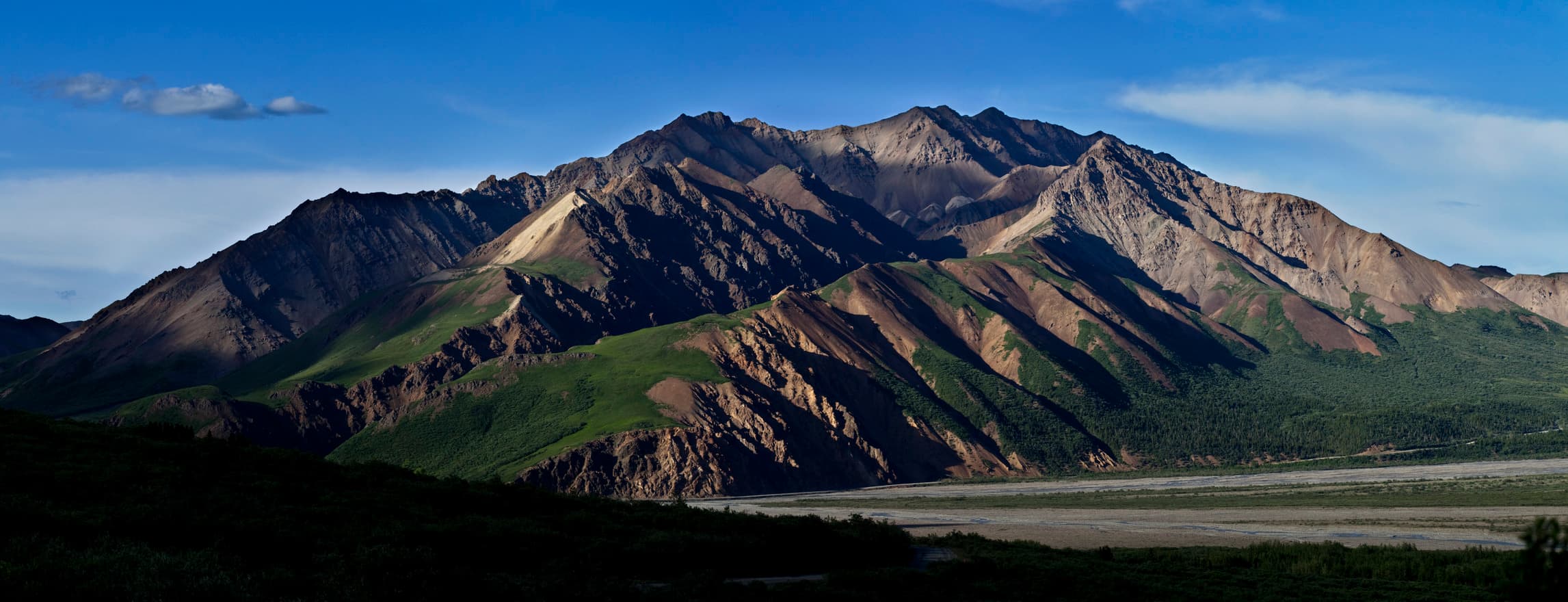
A jigsaw of stolen lands, crowned by granite that is still rising
Alaska Range uplift (terrane accretion + Denali Fault restraining bend)McKinley granites ≤60 Ma (avg K-Ar 57.3 Ma, USGS); uplift ongoing at ~0.5 mm/yr (NPS)Pacific plate vs North American plate; accreted Wrangellia superterrane sutured against Yukon-Tanana and other North American-affinity terranes along the Denali Fault system🌋 none (Paleogene volcanic rocks only, long extinct) — No active volcanoes in Denali National Park — the Alaska Range here is built by faulting and uplift, not volcanism. The USGS Alaska Volcano Observatory is the monitoring authority for Alaska's active volcanoes, all of which lie outside the park; the colorful volcanic rocks at Polychrome are 56-38 million years old (USGS).
Denali exposes an accreted, faulted Alaska Range: terranes welded to North America and lifted along a major strike-slip system.
NPS Photo / Jacob W. Frank. · Public domain · source
Most of the ground beneath Denali is not original North America. For hundreds of millions of years the Pacific plate has acted like a conveyor belt, ferrying island arcs, slivers of seafloor and fragments of distant continents northward and welding them onto Alaska. Geologists call these fragments accreted terranes, and the National Park Service describes the Denali region as a jigsaw puzzle built from them: ancient schists and quartzites of North American affinity (the Yukon-Tanana terrane) in the northern foothills, and the far-travelled Wrangellia island-arc superterrane to the south. The suture running between them is the Denali Fault system — a 2,100 km (1,300 mi) strike-slip structure that arcs from the Yukon border toward the Bering Sea and links, via the Fairweather and Queen Charlotte faults, into the great transform boundary between the Pacific and North American plates.
The mountain itself is younger than the collage it stands on. Around 60 million years ago, magma rose into the deformed marine sediments squeezed between the fault and the newly docked terranes, crystallizing at depth as the McKinley sequence of granite plutons. USGS geochronology puts the average K-Ar age of these granites at 57.3 million years, and rubidium-strontium data show the sequence can be no older than 60 million years. That pale, fresh-looking granite is what climbers grip on the upper mountain today.
Why is Denali, at 20,310 feet (6,190 m), the highest peak on the continent? Part of the answer is geometry. The NPS explains that a large bend in the Denali Fault directly north of the mountain forces rocks to bunch up as the two sides grind past each other — and Denali sits precisely in that bend. The squeeze has not stopped: scientists measure the mountain rising at about half a millimeter per year.
The fault reminds everyone it is alive. On 3 November 2002, a magnitude 7.9 earthquake tore 340 km of surface rupture along the Denali and two related faults — beginning with a 40 km break on a previously unknown thrust fault, running 218 km down the Denali Fault with right-lateral offsets averaging about 5 m and reaching nearly 9 m, then jumping onto the Totschunda Fault for another 76 km. The USGS ranks it among the longest strike-slip ruptures of the past two centuries.
On top of all this tectonics, ice does the sculpting. Glaciers pouring off the range flow more than 40 km and descend over 4,500 vertical meters from the highest peaks, feeding the braided rivers you see from the park road. And in the Cantwell Formation near the road corridor, thousands of trace fossils of hadrosaurs, theropods, pterosaurs, birds and fish record one of the best-preserved Late Cretaceous polar ecosystems known anywhere on Earth.
What you can see on the trail
Denali's granite massif — a ~57-million-year-old pluton still rising
📍 Thorofare Ridge Trail above Eielson Visitor Center (Mile 66, Denali Park Road), or the classic Reflection Pond view near Wonder Lake
The pale upper wall of Denali is a single body of McKinley-sequence granite that crystallized underground roughly 57 million years ago (USGS) and is being squeezed upward in a bend of the Denali Fault at about half a millimeter per year (NPS).
Painted volcanic bands at Polychrome
📍 Polychrome Overlook, around Mile 46 of the Denali Park Road (transit/tour bus stop)
The orange, yellow and lavender slopes are rhyolite tuffs and lava flows — evidence of volcanism that, per the USGS, was active here as recently as 38 million years ago, with most of these rocks closer to 56 million years old.
Ancient terrane basement in the Savage River canyon
📍 Savage River Loop Trail (Mile 15 — the farthest point private vehicles can drive)
The dark, crumpled outcrops in the canyon belong to the park's oldest rocks — late Precambrian to early Paleozoic schist and quartzite of the Yukon-Tanana terrane (NPS), the 'North American' side of the great terrane jigsaw.
Glacier-fed braided rivers
📍 Toklat River rest stop (Mile 53) and the panorama from Eielson Visitor Center
The gravel channels that split and rejoin across kilometer-wide valley floors are fed by glaciers that flow over 40 km and drop more than 4,500 vertical meters off the high peaks (NPS) — the erosion half of the mountain-building equation, happening in real time.
Fun fact
The rock on Denali's 6,190 m summit solidified underground about 57 million years ago — and NPS measurements show the mountain is still rising half a millimeter every year. Meanwhile, in 2002, the fault at its feet unzipped 340 km of ground in a single M7.9 earthquake, with offsets of up to nearly 9 meters.