Himalayan orogeny — Indus Suture Zone (collision boundary) with prior Trans-Himalayan arcarc magmatism ~103–50 Ma; collision onset ~59–50 Ma; ongoingIndian Plate sutured to the Eurasian Plate along the Indus (–Tsangpo) Suture Zone🌋 none — No Holocene volcanoes in Ladakh per the Smithsonian Institution's Global Volcanism Program (India's only listed active volcanism is in the distant Andaman Sea). The Dras arc volcanics along the suture are Cretaceous and extinct; the hot springs at Puga and Chumathang belong to a non-volcanic geothermal field studied by the Geological Survey of India.
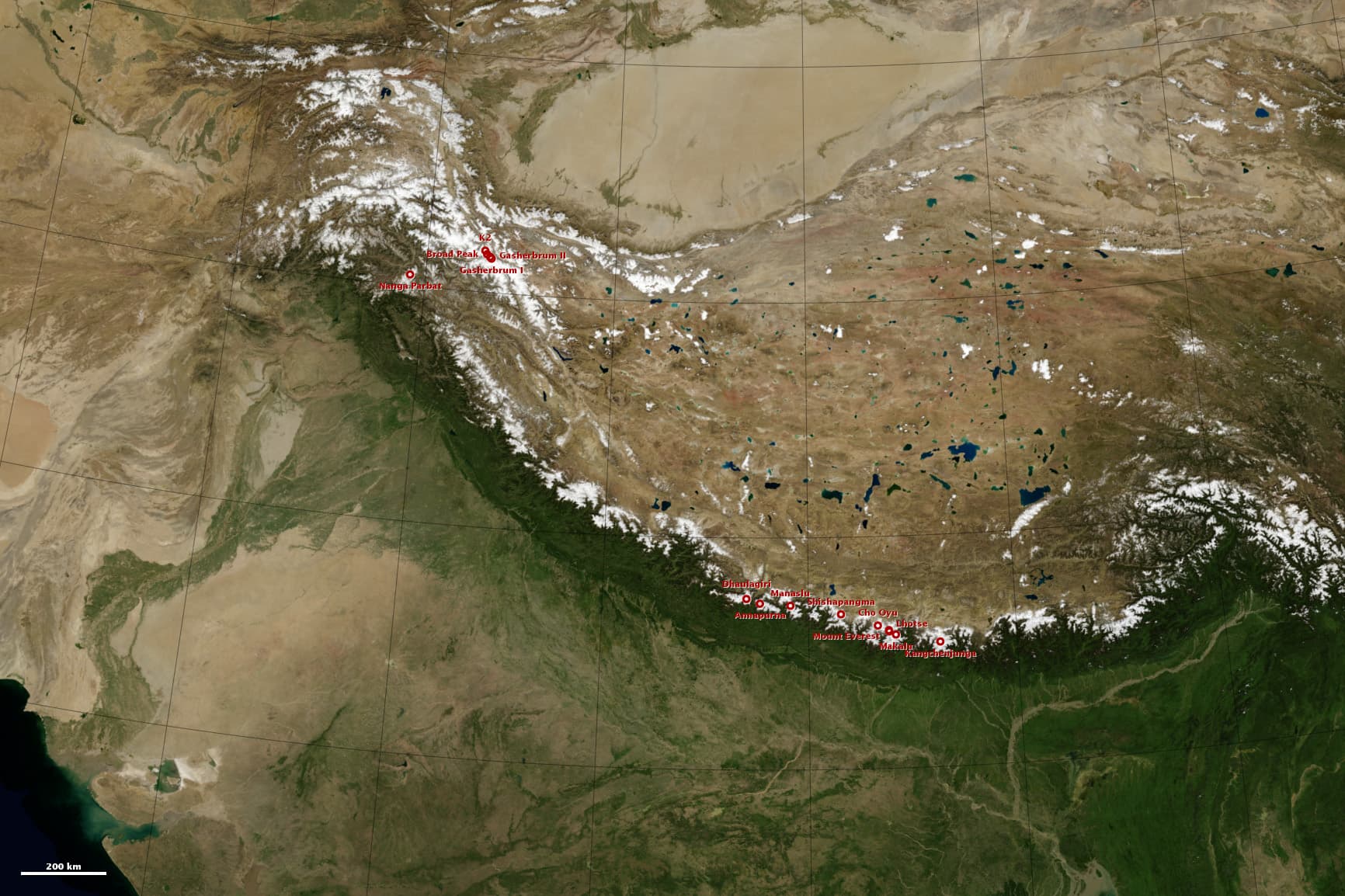
The India-Asia collision: white 8,000-meter peaks along the Himalaya and Karakoram, with the high Tibetan Plateau behind.
NASA Earth Observatory image by Robert Simmon, using Blue Marble and GTOPO30 data. · NASA media use guidelines · source
Most plate boundaries hide under oceans. In Ladakh, the boundary where India met Asia lies open on the surface: the Indus Suture Zone, the belt of crushed and stacked rock marking where the Neo-Tethys Ocean closed and two continents welded together. The Indus River follows this scar for hundreds of kilometres — stand on its banks near Leh and the ranges to the north grew on Asia, while the ranges to the south rode in on India. Evidence from the Indus Basin sedimentary rocks of Ladakh is central to dating the collision itself, with onset estimates in the current literature spanning roughly 59 to 50 million years ago.
Before the collision, Ladakh was Asia's Andean-style edge. As Neo-Tethys seafloor dove northward beneath it, subduction magmas built the Ladakh batholith — part of the more than 2,500-km-long Trans-Himalayan batholith chain. Zircon dating brackets its assembly from about 103 million years ago (a granodiorite near Kargil) to diorites of about 50–51 million years ago near Leh: an arc that died almost exactly when India arrived and shut off the subduction factory. Leh itself, and the Khardung La road above it, are built on this Asian arc granite.
The suture's crown jewels are its ophiolites — slices of actual oceanic crust and mantle that escaped subduction and were thrust onto land. South and east of Leh, the Nidar, Spontang and Karzok ophiolites preserve the anatomy of the vanished Neo-Tethys: pillow lavas, gabbros, peridotites and chromite-bearing mantle rock. The Nidar ophiolite, near Tso Moriri, is one of the best-preserved oceanic-crust sections in the Himalaya, dated close to the Jurassic–Cretaceous boundary and geochemically born above an intra-oceanic subduction zone. Walking these rusty-brown hills at 4,500 m, you are walking on the floor — and the mantle — of an ocean that no longer exists.
The collision's aftermath is written just as clearly. The purple-red conglomerates and sandstones of the Stok Range south of the Indus are molasse: debris shed from the newborn mountains, dumped into the closing seaway and then folded in their turn. And the deformation continues — at Lamayuru, neotectonic activity on the suture zone triggered a landslide that dammed the valley about 35,000 years ago, ponding a lake whose pale silts, exposed when it drained roughly a thousand years ago, erode into the famous 'Moonland' badlands. At Puga, near Tso Moriri, hot springs and boiling pools mark a geothermal field long studied by the Geological Survey of India — the heat of a collision still in progress, in a land with no volcanoes at all.
What you can see on the trail
The Indus–Zanskar confluence — two rivers meeting on the suture
📍 Sangam viewpoint at Nimmu, on the Leh–Alchi road (also the endpoint of Zanskar river routes)
The muddy Zanskar arrives from ranges that rode in on the Indian plate; the Indus it joins flows along the suture zone itself — the actual welding line of the two continents. Few places on Earth let you photograph a continental collision boundary from a roadside viewpoint.
Asia on one side, collision debris on the other — Ladakh Range granite vs. Stok Range red beds
📍 From Leh and Stok village, and from Kongmaru La at the end of the Markha Valley trek
Look north from the Indus: the smooth pinkish-grey Ladakh Range is arc granite of Asia's old margin (~103–50 Ma). Look south: the jagged purple-and-red Stok Range is Indus molasse — conglomerates made of debris eroded from the newborn Himalaya. The valley between them is the suture.
Lamayuru 'Moonland' — pale badlands of a vanished mountain lake
📍 Lamayuru monastery and the Prinkiti La stage of the Sham Valley / Lamayuru–Chilling treks
The cream-yellow, moon-like hills around Lamayuru are silts and muds of a lake formed about 35,000 years ago when tectonically triggered landsliding dammed the valley on the suture zone. The lake drained around a thousand years ago; erosion has been sculpting its floor ever since.
Ophiolite country — ocean floor and mantle rock at 4,500 m
📍 Around Tso Moriri: Karzok village sits beside its namesake ophiolite, and the road route via Chumathang–Sumdo passes the Nidar ophiolite's dark peridotites
The rusty-brown and greenish-black hills here are peridotite and serpentinite — rock from Earth's mantle beneath the Neo-Tethys Ocean, thrust onto land when the ocean closed. Dated near the Jurassic–Cretaceous boundary, it is genuine seafloor you can put your hand on, 4,500 m above today's sea.
Fun fact
In Ladakh you can touch both sides of a continental collision in a single day: granite of Asia's ancient volcanic arc behind Leh, and near Tso Moriri, mantle rock from the floor of the vanished Neo-Tethys Ocean — an entire ocean's remains parked at 4,500 m.
Rocks: granodiorite and granite (Ladakh batholith, Trans-Himalayan arc) · ophiolite suite: peridotite, serpentinite, gabbro, pillow basalt, chromitite (Nidar, Spontang, Karzok) · Indus molasse: red-purple conglomerate and sandstone (Stok Range) · flysch shale and phyllite (Lamayuru Formation, Triassic–Jurassic) · Quaternary lake silts and breccias (Lamayuru 'Moonland')