
The numbers
| Metric | Value | Source |
|---|---|---|
| Distance | 35 mi (official) to 38.5 mi (detailed guide) | Visit VBR; Into the Backcountry |
| Cumulative gain | 6,874 ft | Into the Backcountry |
| Duration | 3 days / 2 nights | Visit VBR |
| High point | 3,197 ft (McAfee Knob) | Wikipedia via Go Hike Virginia |
| Permits | None — "Permits: Not Required" | Into the Backcountry; ATC permits page |
| Fees | $0 — shelters and campsites free, first-come | ATC camping & shelters |
| Legal campsites in the NPS corridor | Exactly 7, along 28 miles | ATC/NPS camping map |
| Shuttle | $6 one-way / $11 round trip, Mar 6-Nov 29, 2026 | Roanoke County |
The distance spread — 35 miles from the destination office, 37 in one detailed account, 38.5 with 6,874 feet of gain in the most granular verified guide — comes down to where you park and which connectors you count. The loop links the Appalachian Trail with three side trails: the blue-blazed Andy Layne, the yellow-blazed North Mountain Trail and the Dragon's Tooth Trail. The honest number is 37-38 miles (Into the Backcountry; Desk to Dirtbag).
The Roanoke Appalachian Trail Club's definition is the clean one: Virginia's Triple Crown — Dragon's Tooth, McAfee Knob and Tinker Cliffs — is the stretch of A.T. between VA 620 (Trout Creek) and VA 652 (RATC). Nobody counts you in. Nobody sells you anything. And yet this is one of the most tightly regulated places to sleep in American hiking.
No permit — but where you sleep is dictated absolutely
The official ATC/NPS notice map is unambiguous: "Along 28 miles of the A.T. camping is only permitted at 7 designated sites." Between VA 624 (Newport Rd) and VA 652 (Mountain Pass Rd) the trail runs a narrow corridor of National Park Service land, and the restriction exists to concentrate environmental impact (ATC/NPS camping map).
The seven legal sites, in the order you meet them northbound from VA 311:
| Site | Role in the plan |
|---|---|
| John's Spring Shelter | First shelter on the McAfee climb |
| Catawba Mountain Campsite | Tent alternative low on the ridge |
| Catawba Mountain Shelter | Last stop before the knob |
| Campbell Shelter | 0.7 mi past the summit — the legal sunrise base |
| Pig Farm Campsite | Ditto, for tents |
| Lamberts Meadow Shelter | The day-one target on the standard split |
| Lamberts Meadow Campsite | Overflow beside it |
Everything else in the corridor is off the table, and the map names the traps explicitly:
- McAfee Knob and Tinker Cliffs are both marked NO CAMPING. The sunrise-on-the-ledge photo is only legal from Campbell Shelter or Pig Farm Campsite, 0.7 mile beyond the summit, plus a headlamp walk back up (Go Hike Virginia; ATC/NPS map).
- The Andy Layne Trail crosses private land — camping banned along the whole approach. The Carvins Cove watershed bans it entirely.
- Fires only in the metal rings at designated sites — "NO campfires outside of metal fire rings" is RATC's phrasing (RATC).
- On the Forest Service lands either side of the corridor — which include the Dragon's Tooth end of the loop and the North Mountain ridge — dispersed camping is legal again. That asymmetry is what makes the three-day plan below work.
This is the inverse of a permit system: free entry, dictated sleep. Treat the seven-site list as a quota, because functionally it is one.
Continue reading Dragon's Tooth and Tinker Cliffs as day hikes: the Triple Crown à la carte →
Since June 2026, your food sleeps locked up too
After a mother bear and cubs took hikers' food at Catawba Mountain Shelter — unafraid of the people present — the National Park Service now requires overnight hikers in the Triple Crown area to store food, trash and all scented items in the provided bear boxes, cables or poles, in an IGBC-approved bear canister, or in a proper hang: 12 feet up, 6 feet out. The ATC's notice (updated June 16, 2026) names Campbell Shelter and Pig Farm Campsite as frequent-activity sites — precisely the two places the sunrise plan puts you — and "strongly recommends" carrying a canister (ATC bear notice).
This is a requirement, not advice — and it is new enough that older trip reports won't mention it.
Water is the actual crux
Summits under 3,200 feet mean zero altitude problem. The problem is that these ridges are dry (Into the Backcountry):
- Day one's water is only at the A.T. shelters. Fill at every spring you pass; there is nothing at the overlooks.
- Day two crosses a ~12-mile dry stretch on the North Mountain ridge. Leave camp full.
- The Dragon's Tooth camping area has no water at all. RATC's warning is blunt: "There are no natural water sources along the A.T. in the Dragons Tooth area, so bring all your water if planning to camp in that area" (RATC). Every liter you drink and cook with at the night-two camp walks up Cove Mountain on your back.
Carry more capacity than a 3,000-foot East Coast ridge suggests you need — this is a Colorado-style water plan at one-quarter the elevation, with mid-Atlantic heat and humidity doing the enforcement.
The three-day plan
The most detailed verified guide runs the loop as a 12.9 / 15.6 / 10-mile split (Into the Backcountry). Staged McAfee-first, the camping rulebook and the water problem line up instead of colliding.
Day one — VA 311 over McAfee Knob to Lamberts Meadow (~13 mi)
From the VA 311 trailhead — parked or shuttled (below) — cross the 90-foot pedestrian bridge that has carried the A.T. over the highway since March 2025 (VDOT). Follow the white blazes north past the corridor's first shelters, topping up water at each. The famous ledge arrives about 4 miles in at 3,130 feet — McAfee Knob draws roughly 50,000-60,000 visitors a year, so expect company at the diving board (RATC; WDBJ7). No tents, no fires here — continue along Tinker Mountain to Tinker Cliffs, a half-mile line of Tuscarora quartzite walked right on the edge, with 180-degree views back to the knob (Visit VBR). Also NO CAMPING. Drop past Scorched Earth Gap to Lamberts Meadow Shelter or Campsite for the night.
The sunrise variant: photographers stop early at Campbell Shelter or Pig Farm, 0.7 mile past the knob, and walk back up in the dark. Legal, spectacular — and it front-loads tomorrow, pushing Tinker Cliffs into an already long day two. Pick one: the photo or the balanced split.
Day two — Andy Layne down, North Mountain across (~15-16 mi, mostly dry)
Climb back to Scorched Earth Gap and take the blue-blazed Andy Layne Trail down: 3 miles through cement-company pastureland with two creek footbridges, 100+ built steps and actual cows (Go Hike Virginia). This is private land held open by goodwill — no camping here, ever. Fill bottles at the creeks, because the yellow-blazed North Mountain Trail that follows is the ~12-mile dry stretch. At the far end, drop to VA 620 at Trout Creek and tank up for a dry camp: the climb toward Dragon's Tooth sits on Forest Service land outside the NPS corridor, so dispersed camping is legal here — the loop's one night of freedom, priced in water weight.
Day three — Dragon's Tooth and out (~10 mi)
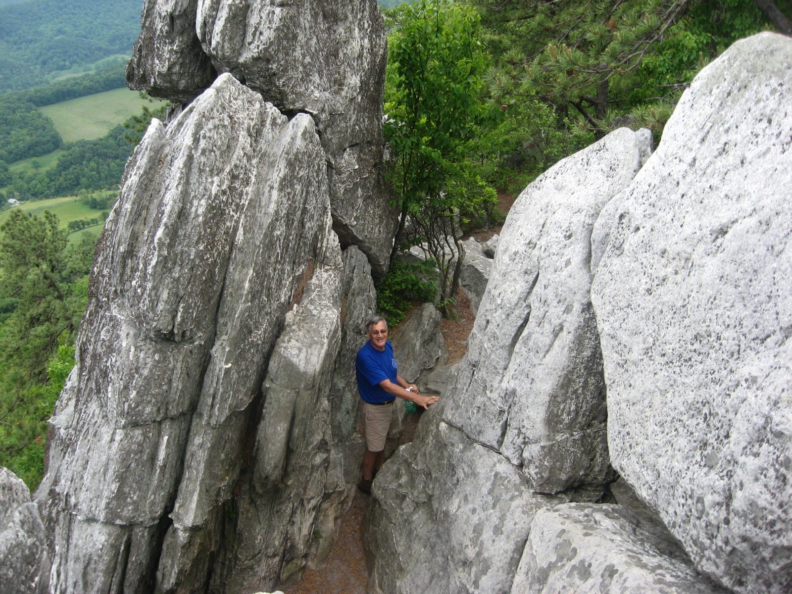
The final A.T. section to the ridge of Cove Mountain (2,889-ft area) uses iron rungs set into the rock and demands, in Go Hike Virginia's inventory, "full access to hands, feet, elbows, toes, fingers and knees." The Tooth itself is a 35-foot spire of Tuscarora quartzite you can scramble for an airy perch (Go Hike Virginia). Fair weather only — this rock is treacherous wet, and the rungs are the crux of the whole loop. Then descend and close the circuit through the Catawba Valley back to VA 311 — passing 0.3 mile from the donation-based Four Pines Hostel (The Trek) — or peel off at the Dragon's Tooth trailhead and let the shuttle close the loop for you. The classic finish is back: Catawba's Homeplace Restaurant, the family-style farmhouse generations of thru-hikers called the best meal on the trail, reopened April 22, 2026 after five years dark — Wed-Fri 4-8 p.m., Sat-Sun 11 a.m.-8 p.m. (WDBJ7).
Parking, the tow truck, and the $6 bus
The bottleneck here is not money or permits — it is asphalt. The VA 311 lot is ~50 gravel spaces that fill early; roadside parking on Route 311 is banned and ticketed/towed (Roanoke County). A $6.3 million federal award (February 26, 2026) will rebuild the trailhead into 100+ striped spaces with restrooms and a permanent shuttle stop — which means construction: check status before trusting the lot (WDBJ7).
The fix is the shuttle — treat it as the default, not the fallback:
| Item | 2026 detail |
|---|---|
| Season | March 6 - November 29, Fri/Sat/Sun + Memorial and Labor Day Mondays |
| Fare | $6 one-way / $11 round trip (+ fees), 20 seats per run |
| Hours | 7 a.m.-7 p.m. April-September; shorter in shoulder months |
| Stops | I-81 Exit 140 Park & Ride, Orange Market (311), downtown Salem, Longwood Park, Dragon's Tooth trailhead, McAfee Knob trailhead |
Source: Roanoke County; booking at McAfeeShuttle.com, timetable at route & schedule.
Because the bus serves both the McAfee and Dragon's Tooth trailheads, it solves the loop's two classic problems at once: no car shuffle if you exit at Dragon's Tooth, and no towed car if the lot was full at dawn. Almost no US trail region can say that.
Timing: read the thru-hiker tide chart
The seven legal campsites are first-come, and once a year a wave of long-distance hikers arrives to claim them. The ATC's 2025 registers logged 2,187 northbound thru-hike starts, clustered from early March to early April (ATC; The Trek). By mid-May the bubble is at Trail Days in Damascus — 25,000 people, May 15-17 in 2026 (Visit Damascus). Catawba Mountain Shelter sits at northbound mile 713.3 (ATC bear notice), so the wave rolls over the Triple Crown roughly late May through June — exactly when the seven sites fill.
The play: off-wave weekdays, or September-October, when the humidity breaks. Overlapping the wave anyway? Reach camp early, carry a plan B site from the seven, and be flawless on bear storage — the June 2026 rule exists because the wave's food taught a bear where dinner lives.
Three days, zero permits, $11 of transport, seven places you may legally sleep. The rulebook is absolute, but it fits on an index card — and the loop built around it is the best free backpacking itinerary on the East Coast.
20 Sources
- ratc.orgRATC — McAfee Knob and Virginia's Triple Crown — definition, water warnings, fire rule, visitor count
- ratc.orgATC/NPS camping-restriction map (RATC-hosted PDF) — 28 miles, 7 sites, NO CAMPING zones
- intothebackcountryguides.comInto the Backcountry — Virginia's Triple Crown Loop guide — 38.5 mi / 6,874 ft, 12.9/15.6/10 split, water scarcity, "Permits: Not Required"
- visitroanokeva.comVisit Virginia's Blue Ridge — Triple Crown — 35 mi / 3 days, camping prohibitions
- desktodirtbag.comDesk to Dirtbag — Backpacking Virginia's Triple Crown — 37-mile account
- appalachiantrail.orgATC — McAfee Knob area: ongoing bear activity — mandatory food storage, mile 713.3
- appalachiantrail.orgATC — Permits & fees — no permits in the region
- appalachiantrail.orgATC — Camping & shelters — free, first-come shelters
- roanokecountyva.govRoanoke County — McAfee Knob Trailhead Shuttle — season, fares, stops, towing
- mcafeeshuttle.comMcAfeeShuttle.com and route & schedule — booking, timetable
- gohikevirginia.comGo Hike Virginia — McAfee Knob — distances, elevations, shelters
- gohikevirginia.comGo Hike Virginia — Dragon's Tooth — rungs, spire, wet-rock warning
- gohikevirginia.comGo Hike Virginia — Tinker Cliffs — Andy Layne Trail detail
- visitroanokeva.comVisit VBR — Tinker Cliffs — cliff line, views
- vdot.virginia.govVDOT — A.T. pedestrian bridge opens — bridge specs, March 2025
- wdbj7.comWDBJ7 — $6.3M McAfee Knob trailhead upgrade — parking rebuild
- appalachiantrail.orgATC — 2,000-milers — 2025 start counts
- thetrek.coThe Trek — 2025 thru-hiker survey — start-date clustering
- visitdamascus.orgVisit Damascus — Trail Days — mid-May scale
- wdbj7.comWDBJ7 — Homeplace reopening — April 22, 2026, hours