Tectónica de placas: el motor bajo tus botas
Cada sendero de esta guía existe porque el suelo se mueve. La capa exterior rígida de la Tierra está rota en una docena de placas mayores — losas de corteza y manto superior de unos 100 km de espesor — que se deslizan sobre la roca más caliente y débil que tienen debajo. El motor es el calor que escapa del interior del planeta: el manto se revuelve lentamente, nace fondo oceánico nuevo en las dorsales y el fondo viejo, frío y denso se hunde de vuelta en las fosas, arrastrando las placas como tramos de una cinta transportadora. Suena abstracto hasta que descubrís que la velocidad cabe en tu mano: las placas se mueven más o menos al ritmo al que crecen tus uñas. La dorsal del Atlántico se abre unos 2,5 cm por año; las placas más rápidas alcanzan 8–10 cm por año.
Ese ritmo parece ridículamente lento — hasta que lo multiplicás por el tiempo geológico. Dos centímetros y medio por año son 25 kilómetros cada millón de años. Sostenlo durante 100 millones de años y habrás abierto un Atlántico o cerrado un océano entero. Una cordillera no necesita ninguna catástrofe: el movimiento paciente, a velocidad de uña, sostenido más tiempo del que la mente humana puede abarcar, basta para levantar el Himalaya y los Andes, y para partir Islandia lentamente en dos.
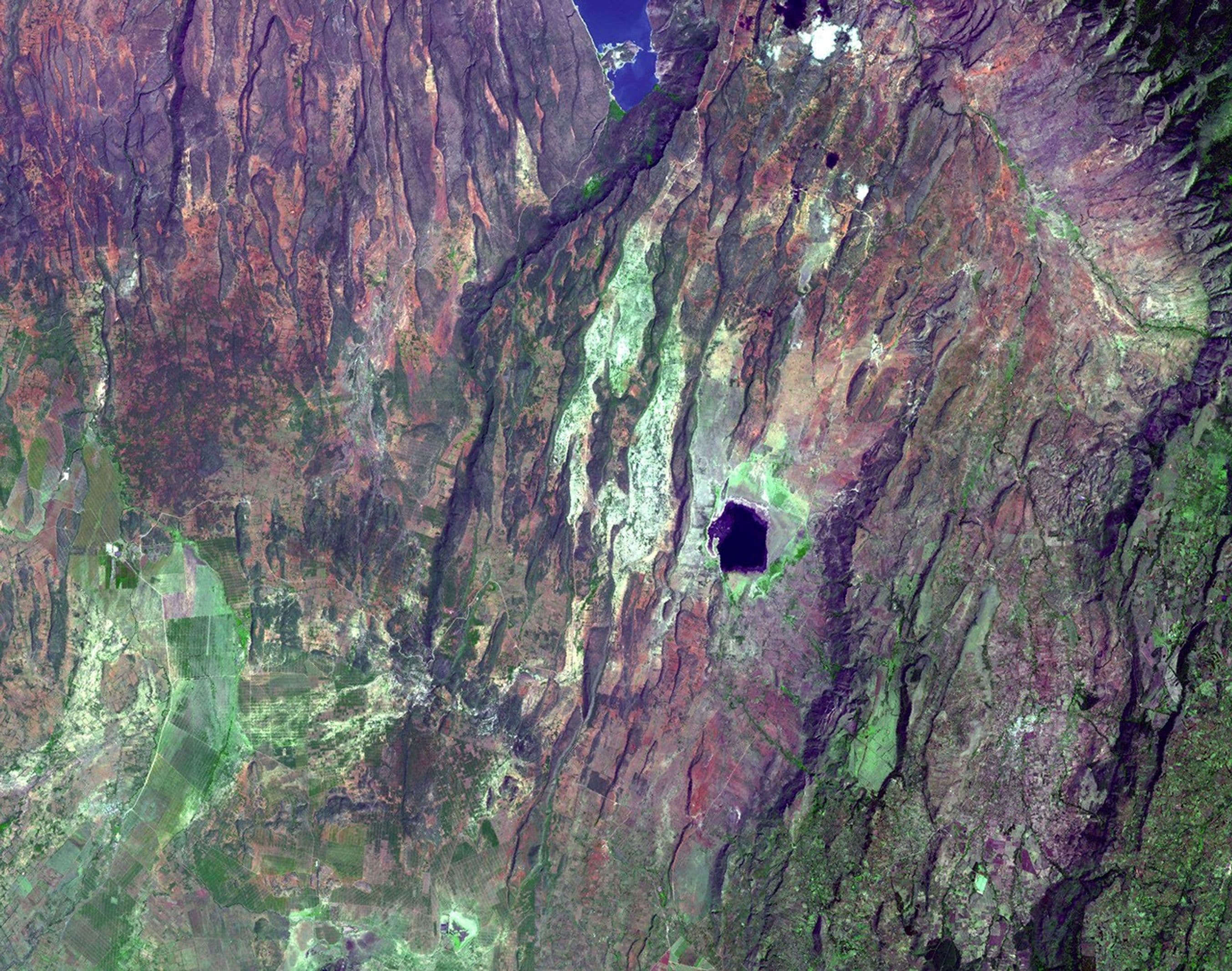
Casi todo lo que le importa a un trekker ocurre donde las placas se encuentran. Donde se separan, hay valles de rift y dorsales volcánicas. Donde se rozan de costado, hay grandes fallas de desgarre como la falla Denali en Alaska. Y donde convergen — una placa hundiéndose bajo otra, o dos continentes chocando de frente — están los cinturones montañosos del planeta, sus arcos volcánicos y la mayoría de sus grandes terremotos. Las tres secciones siguientes son, en el fondo, un recorrido por las distintas maneras en que chocan las placas, y por las montañas radicalmente diferentes que construye cada estilo de choque. Cuando estés parado en una cumbre de esta guía, estarás parado sobre el resultado visible de ese motor — que sigue funcionando, ahora mismo, bajo tus botas.
Tres maneras de construir una montaña: colisión, subducción y acreción
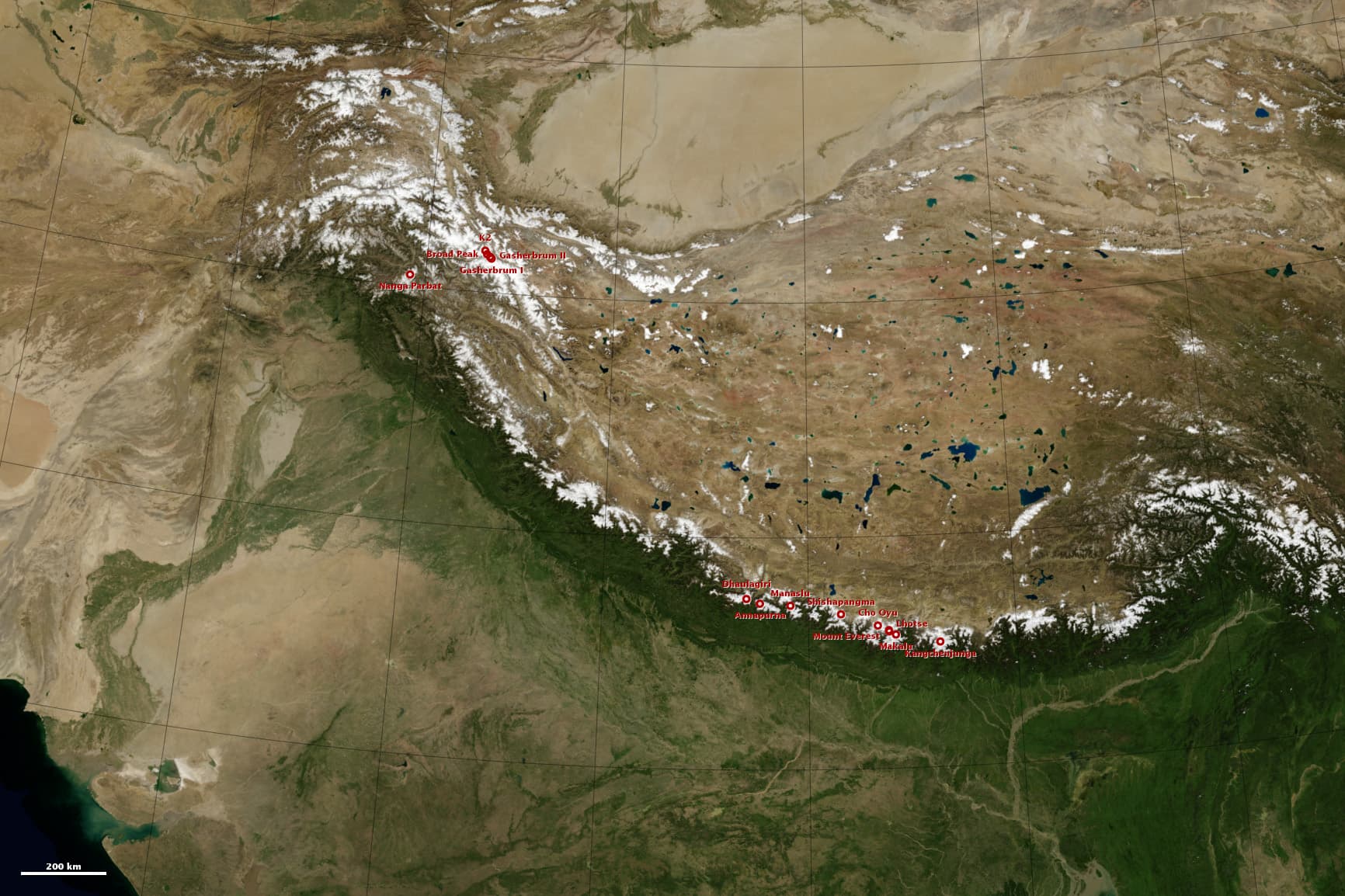
El Himalaya es lo que pasa cuando dos continentes chocan de frente. Hace unos 40–50 millones de años, India — que venía corriendo hacia el norte a través de un océano tras separarse del supercontinente austral — se estrelló contra Asia. La corteza continental es demasiado liviana y flotante para hundirse en el manto, así que ninguno de los dos pudo apartarse: como dos icebergs en colisión, la corteza se plegó, se apiló y se engrosó, levantando el Himalaya y la inmensa meseta del Tíbet detrás. Esto es una orogenia de colisión, y explica los rasgos característicos del Himalaya: altura descomunal, pocos volcanes (ninguna placa se hunde lo suficiente para generar magma) y terremotos incesantes, porque India sigue empujando contra Asia hoy y la cordillera sigue subiendo.
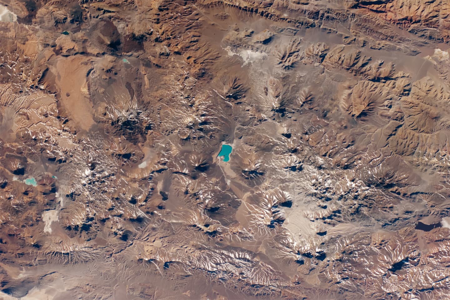
Los Andes se construyen con otro mecanismo: la subducción. Frente a la costa oeste de Sudamérica, la placa oceánica de Nazca se hunde bajo el continente a unos 6–9 cm por año — una de las convergencias más rápidas del planeta. A medida que la placa desciende, el agua que libera baja el punto de fusión del manto que tiene encima y genera magma, que asciende para alimentar una cadena de volcanes a lo largo de todo el margen. El resultado es la cordillera continental más larga del mundo, salpicada de unos 200 volcanes potencialmente activos, desde el Lanín y el Villarrica en la Patagonia hasta los gigantes de Atacama. Los cinturones de colisión como el Himalaya están arrugados; los de subducción como los Andes están arrugados y además alimentados con magma desde abajo — por eso un trekking andino termina tantas veces sobre un volcán.
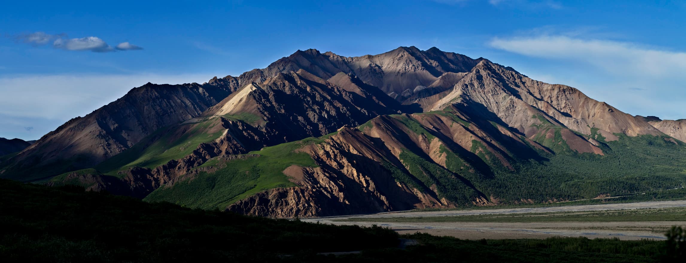
Denali muestra una tercera receta, más extraña: la acreción. El sur de Alaska es un rompecabezas de «terranes»: fragmentos de arcos de islas volcánicas, astillas de fondo marino y pedazos de otros continentes que viajaron hacia el norte sobre placas oceánicas durante cientos de millones de años. Cada fragmento era demasiado grueso y flotante para subducirse, así que uno por uno chocaron contra Norteamérica y quedaron soldados, construyendo Alaska hacia afuera como capas de papel maché. El propio Denali es el núcleo expuesto de un plutón de granito — magma que cristalizó a gran profundidad — empujado luego hacia el cielo por la compresión tectónica en una curva de la falla Denali, de 2.000 km de largo, parte del gran sistema de desgarre entre las placas del Pacífico y de Norteamérica. Con sus 6.190 m, es el techo de un continente armado con piezas de repuesto.
El mismo motor, tres productos. La colisión frontal de continentes da el Himalaya: colosal, sísmico, pobre en volcanes. La subducción de océano bajo continente da los Andes: largos, lineales, volcánicos. La acreción por partes más un quiebre de falla da el Denali: un monolito de granito que se alza sobre un mosaico. Aprendé a reconocer las firmas y cada horizonte se vuelve legible.
Formas de volcán: por qué el cono sigue a la química
Podés leer la química de un volcán desde el valle de enfrente, porque su silueta es un gráfico de cómo fluye su lava. La variable clave es la sílice. El basalto, pobre en sílice, es fluido: se derrama kilómetros antes de congelarse y construye escudos anchos y de pendiente suave. Los magmas ricos en sílice, como la andesita y la dacita, son viscosos y cargados de gas: se apilan cerca de la boca y explotan cada tanto, construyendo conos empinados con capas alternadas de lava y ceniza. El USGS agrupa los volcanes en unos pocos tipos principales — escudos, conos compuestos (estratovolcanes), conos de ceniza, domos de lava — pero la regla de fondo es simple: cuanto más pegajoso el magma, más empinado y más peligroso el volcán.
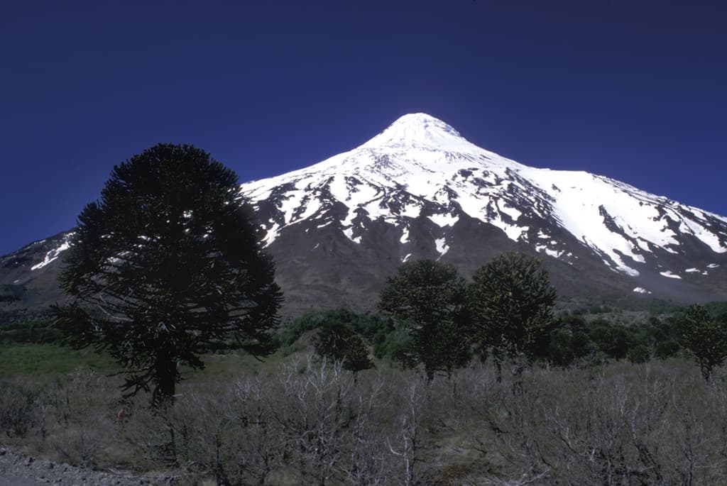
El Lanín, en la frontera argentino-chilena, es el arquetipo de estratovolcán: un cono coronado de hielo de unos 3.750 m, tan simétrico que parece dibujado con compás. Es un volcán de subducción, alimentado por el hundimiento de la placa de Nazca, y su perfil perfecto registra miles de erupciones alternadas — colada de lava, capa de ceniza, colada de lava — apiladas como un hojaldre. No tiene erupciones históricas, pero el registro geológico muestra actividad repetida en los últimos 10.000 años, la más reciente hace unos 2.200: dormido, no extinto, como casi todos los conos lindos que vas a cruzar en los Andes.
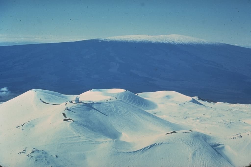
Mauna Kea es la respuesta opuesta. Alimentado no por subducción sino por un punto caliente del manto bajo la placa del Pacífico en movimiento, sus basaltos fluidos se extienden en lugar de apilarse, construyendo una montaña tan ancha que sus laderas rara vez se sienten empinadas. Y sin embargo, con una medida honesta, es la montaña más alta de la Tierra: unos 4.207 m sobre el nivel del mar, más unos 6.000 m escondidos bajo las olas — más de 10 km desde su base en el fondo oceánico hasta la cumbre, superando con holgura la altura del Everest sobre el mar. En su vejez entró en una fase «post-escudo» de lavas más pegajosas, que construyeron los conos de ceniza que le dan a la zona de la cumbre ese aspecto marciano y grumoso.
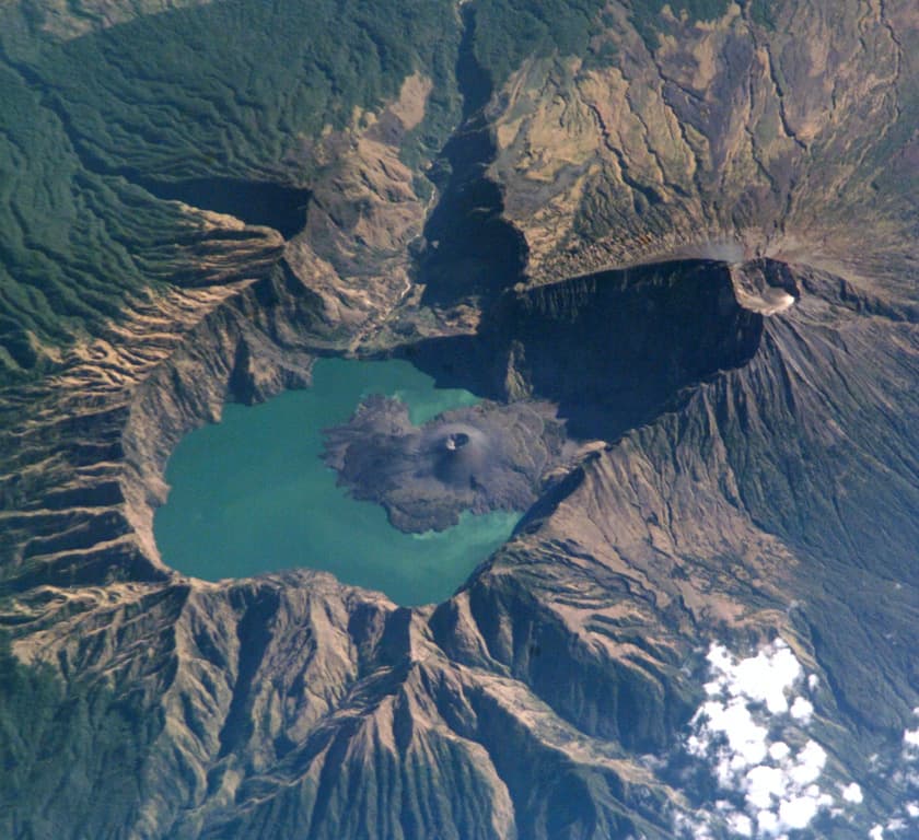
El Rinjani, en Lombok, muestra qué significa la tercera forma. Junto a la cumbre actual se alzaba un volcán mayor, el Samalas. En el año 1257 vació su reservorio de magma en una de las erupciones más potentes de los últimos varios miles de años (IEV 7); el edificio, ahuecado, colapsó sobre el vacío y dejó una caldera de 6 por 8,5 km que hoy acuna el lago en medialuna de Segara Anak. El sulfato de esa única erupción quedó preservado en los hielos de ambos polos, y enfrió el clima del mundo entero. Una caldera no es una montaña que el volcán construyó: es el agujero que quedó donde había una montaña, con un cono joven creciendo ya dentro del lago. Cuando tu sendero recorre un borde circular inmenso, estás caminando la cicatriz de una detonación.
Leer las rocas en el sendero: granito, caliza y rocas volcánicas
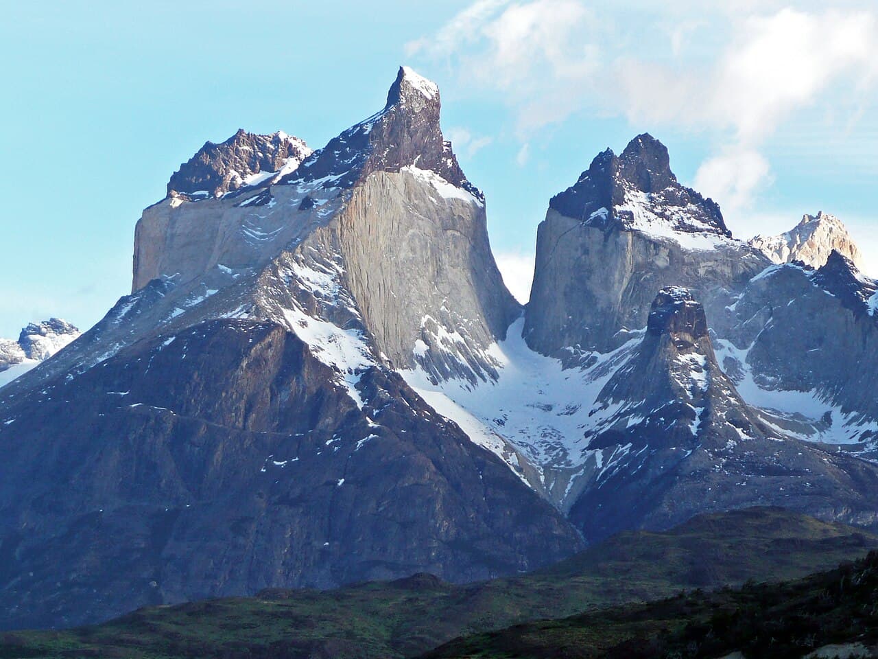
Tres familias de rocas cubren casi todo lo que un trekker va a pisar en su vida, y cada una te dice dónde estás parado en la historia profunda del paisaje. La primera prueba no cuesta nada: mirá de cerca. El granito es inconfundible — un mosaico «sal y pimienta» de cristales entrelazados, lo bastante grandes para verlos uno por uno: cuarzo gris vidrioso, feldespato blanco o rosado en bloques, escamas brillantes de mica. Cristales grandes significan enfriamiento lento, y enfriamiento lento significa profundidad: el granito es magma que nunca llegó a erupcionar, cristalizado a kilómetros bajo tierra en las raíces de una cordillera. Así que cuando caminás sobre granito — bajo las torres del Fitz Roy o de Torres del Paine, o en las laderas del Denali — el mensaje es dramático: todo lo que alguna vez estuvo encima de esta roca fue arrancado por la erosión. Estás cruzando el sótano de una cordillera desaparecida, y como el granito se erosiona en formas audaces cortadas por diaclasas, produce las paredes y agujas más limpias y verticales del trekking mundial.
La caliza habla más bajo pero dice algo más extraño. Gris a crema, de grano fino y depositada en estratos nítidos, es fondo marino compactado: conchas y esqueletos de vida marina acumulados y cementados en piedra. La prueba clásica de campo es una gota de ácido diluido — la caliza verdadera burbujea cuando reacciona la calcita — pero el sendero te da pistas más fáciles: fósiles (conchas, corales, tallos de lirios de mar), crestas filosas acribilladas de dolinas y cuevas, y una ausencia sospechosa de arroyos superficiales, porque el agua disuelve la caliza y corre por debajo. El país de la caliza siempre significa lo mismo: estás caminando sobre un mar antiguo. Las torres pálidas de los Dolomitas son arrecifes del Triásico alzados hacia el cielo, y la propia cumbre del Everest está coronada por caliza marina.
Las rocas volcánicas son lo contrario del granito: los mismos magmas, pero que llegaron a la superficie y se congelaron rápido. Enfriamiento rápido significa cristales demasiado pequeños para verse — basalto y andesita opacos, de grano fino, negros o grises, a veces veteados con bandas de flujo congeladas. Las delatan las texturas: vesículas (agujeros de burbujas de gas), escoria roja o negra y desmenuzada, piedra pómez tan liviana que flota en el agua, y las elegantes columnas hexagonales que forma el basalto cuando las coladas gruesas se enfrían y se agrietan. En un sendero de estratovolcán como el Lanín o el Rinjani, fijate cómo alterna el suelo — lava sólida acá, ceniza y lapilli sueltos allá. Estás subiendo las capas reales de erupciones pasadas, una por una.
Un resumen de un vistazo para el sendero: cristales visibles y entrelazados = granito = las entrañas exhumadas de una cámara magmática. Estratos grises finos con fósiles, cuevas y sin arroyos = caliza = un fondo oceánico levantado. Roca oscura, de grano fino o burbujeante, en capas = volcánica = erupciones tan jóvenes que la montaña quizás no haya terminado. Preguntale a cualquier afloramiento «¿dónde te formaste?» — en la profundidad, bajo el mar, o en la superficie entre fuego — y el paisaje empieza a contestar.
Tiempo profundo: el fondo marino en la cumbre
Este es el dato más desconcertante de toda la geología de montaña: la cumbre del Everest está hecha de fondo marino. El techo del mundo está coronado por la Formación Qomolangma — caliza marina bien estratificada del período Ordovícico, de unos 450–470 millones de años, con fragmentos de trilobites, braquiópodos, ostrácodos y crinoideos (lirios de mar). Esas criaturas vivieron y murieron en un mar cálido y poco profundo mucho antes de que existieran los árboles, antes de que nada caminara sobre la tierra firme. Su cementerio compactado se alza hoy a 8.849 metros, izado hasta ahí cuando la colisión en cámara lenta de India contra Asia arrugó hacia arriba el viejo margen oceánico. Los montañistas que jadean en la zona de la muerte están, en el sentido más literal, parados sobre un fondo oceánico.
Los números que hacen posible esto — millones y miles de millones de años, «Ma» y «Ga» para los geólogos — desafían la intuición, así que usá un truco de trekker: proyectá los 4.540 millones de años de la Tierra sobre un trekking de 100 kilómetros. Cada kilómetro que caminás son unos 45 millones de años. Marchás durante días por un mundo sin vida visible; los primeros mares llenos de fósiles del Cámbrico recién aparecen cerca del kilómetro 88. La caliza de la cumbre del Everest se forma hacia el kilómetro 90. Los dinosaurios desaparecen a solo 1,5 km del final. Toda la historia humana — la agricultura, las ciudades, cada palabra jamás escrita — ocupa los últimos 11 centímetros: menos de media pisada de bota. En este sendero, el Himalaya empieza a levantarse a un día de caminata de la meta.
El tiempo profundo es también lo que convierte el movimiento a velocidad de uña en montañas, y podés sentirlo con aritmética simple. Una placa que repta a 5 cm por año recorre 50 km en un millón de años — y 5.000 km en cien millones. Así cruzó India un océano entero; así la placa de Nazca sigue alimentando los Andes; por eso «lento» e «imparable» significan lo mismo en geología. El levantamiento funciona igual: unos pocos milímetros por año, casi cancelados por la erosión, se acumulan durante millones de años hasta dar un Everest — mientras ríos y glaciares tallan casi tan rápido como sube la roca, que es la razón de que las montañas tengan valles.
Llevá el tiempo profundo como una destreza más del sendero. Cuando levantás a 5.000 metros una piedrita gris con el tallo de un lirio de mar adentro, tenés en la mano un animal que murió hace 450 millones de años, y la montaña a tu alrededor es su lápida — que sigue subiendo unos milímetros por año y sigue siendo demolida por cada arroyo que cruzás. Nada en un trekking está terminado. Estás caminando por un solo fotograma de una película larguísima.